The iconic Matterhorn (4,478 m = 14,692 ft), located on the border between Switzerland and Italy, rises through a canopy of low hanging clouds into a clear blue sky above.
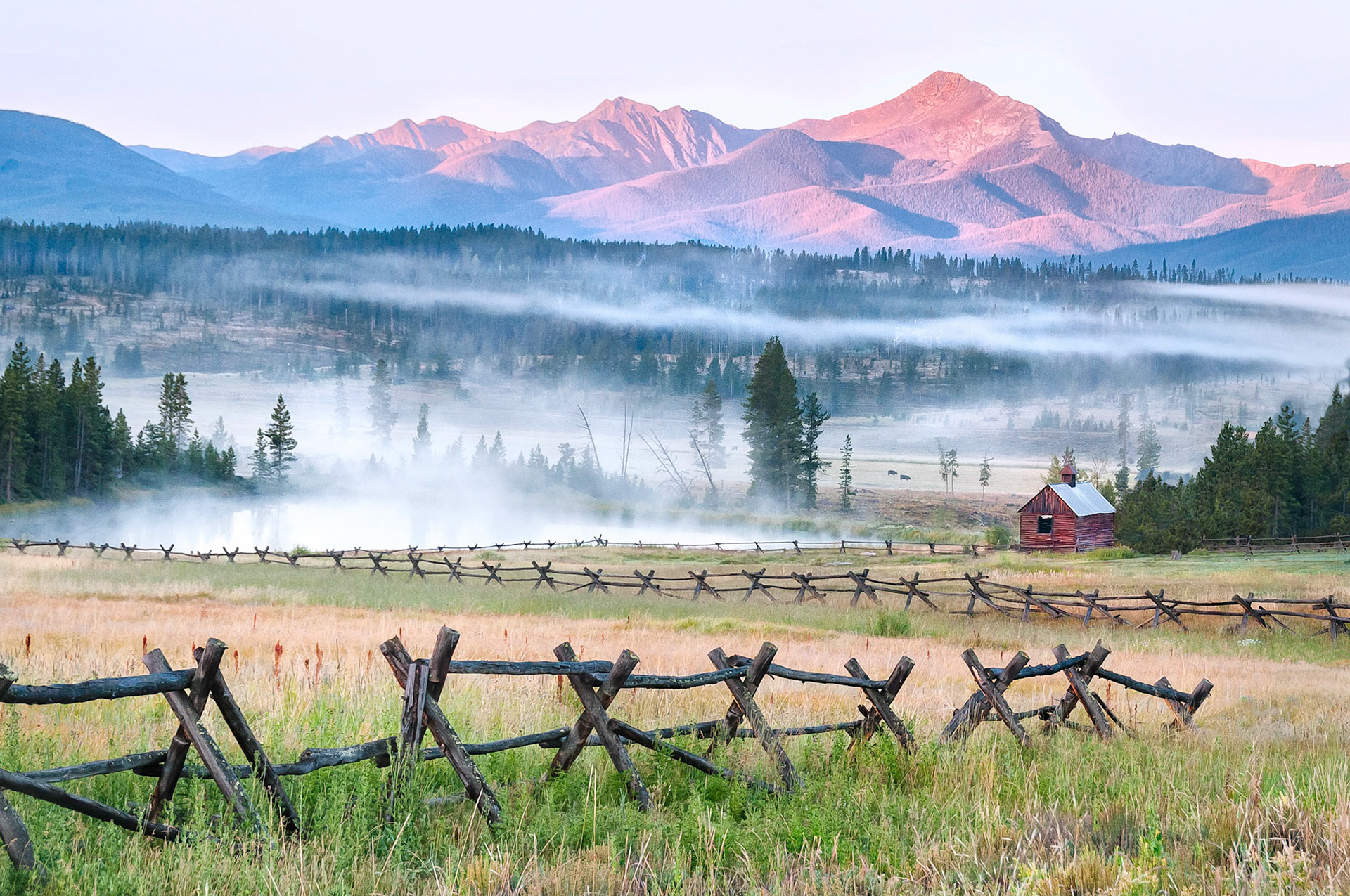
Sunlight clips Byers Peak near Fraser, Colorado, USA as the early morning fog lifts from the valley floor and mists rise from a water catchment pond. An old unused barn and dilapidated log-rail fences yield to the ravages of time.
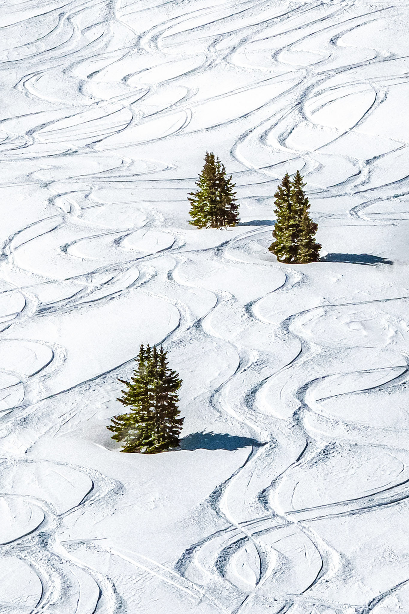
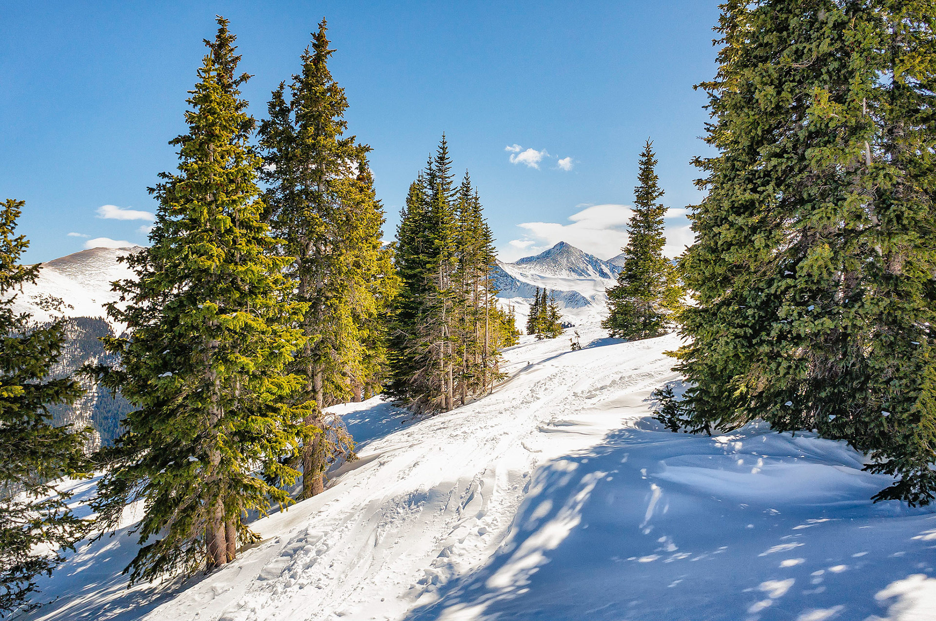
Skiers enjoyed making these winding tacks down a slope covered by a fresh fall of powder snow at Copper Mountain in Colorado, USA.
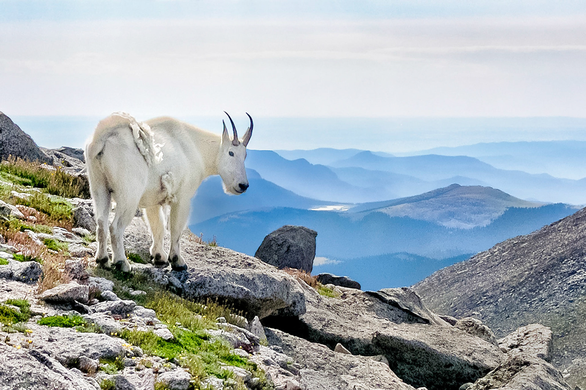
A female Mountain Goat casts a wary glance towards intruders as she enjoys a fine day on the slopes of Mount Spalding, (13,842 feet = 4,109 meters), in the Mount Evans Wilderness Area, Colorado, USA.
The afternoon sun casts its long shadows on the snow and lights lodge-pole pine trees on the slopes of Copper Mountain, Colorado, USA. In the distance, is Peak 8 from the neighbouring Breckenridge ski resort at 12,990 feet, (3,960 m). It is one of the peaks on the Ten Mile Range.
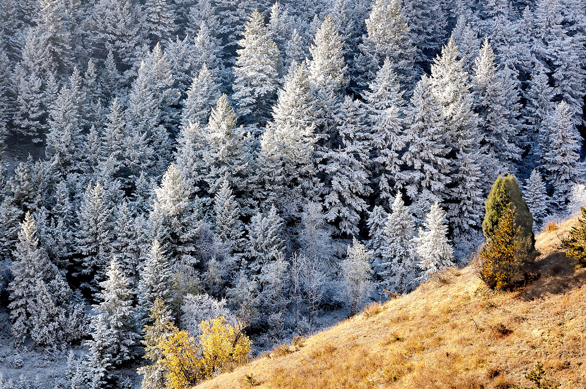
Snows from a brief overnight autumn storm have already melted away on the sunny side of a gully in Genesee, Colorado, USA, while the stand of pine trees growing on the shaded side of the gully were still covered with a dusting of snow.
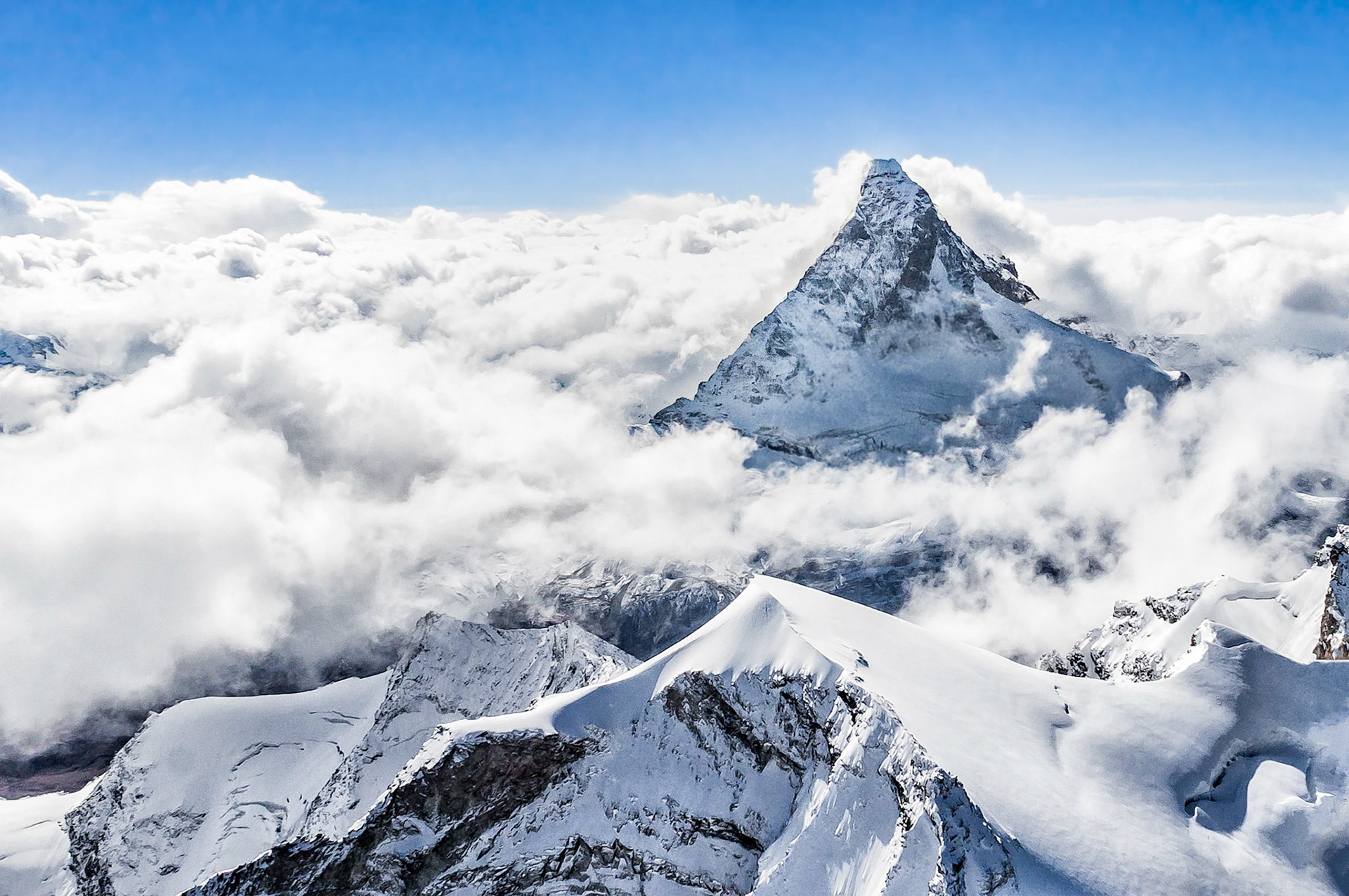
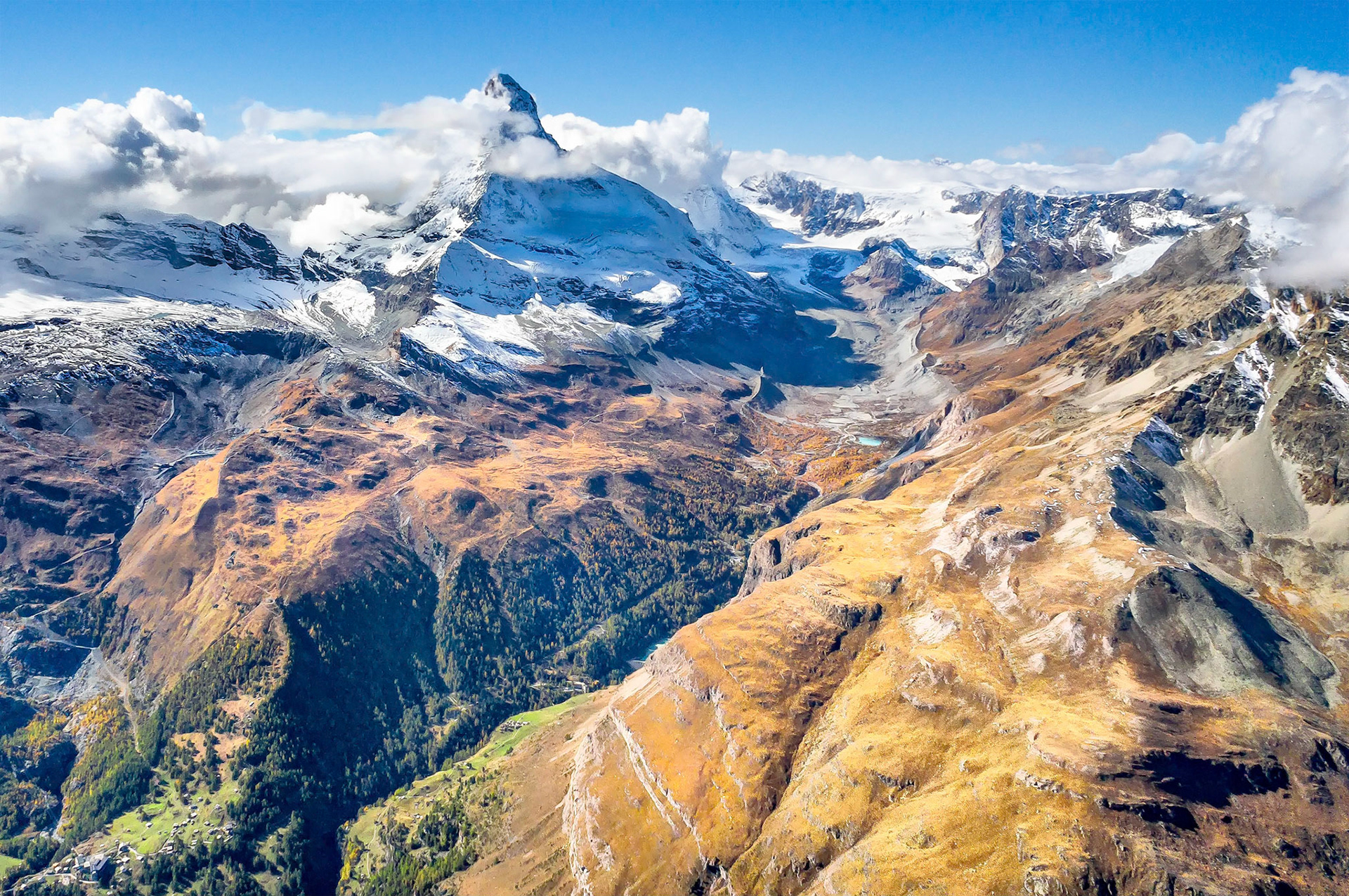
The Matterhorn, (4,478 m = 14,692 ft), is an iconic geologic feature located on the border between Switzerland and Italy. From a helicopter above Zermatt, magnificent views can be seen extending along the Pennine Alp chain. Here the Matterhorn is shrouded by a cloak of incoming storm clouds.
Formed by glacial action, this Swiss alpine skyline rises dramatically against the distant clouds of an incomming storm. Zermatt lies in the valley beyond the rugged ridgeline. The top of the iconic Matterhorn peaks through the clouds on the far right of the image.
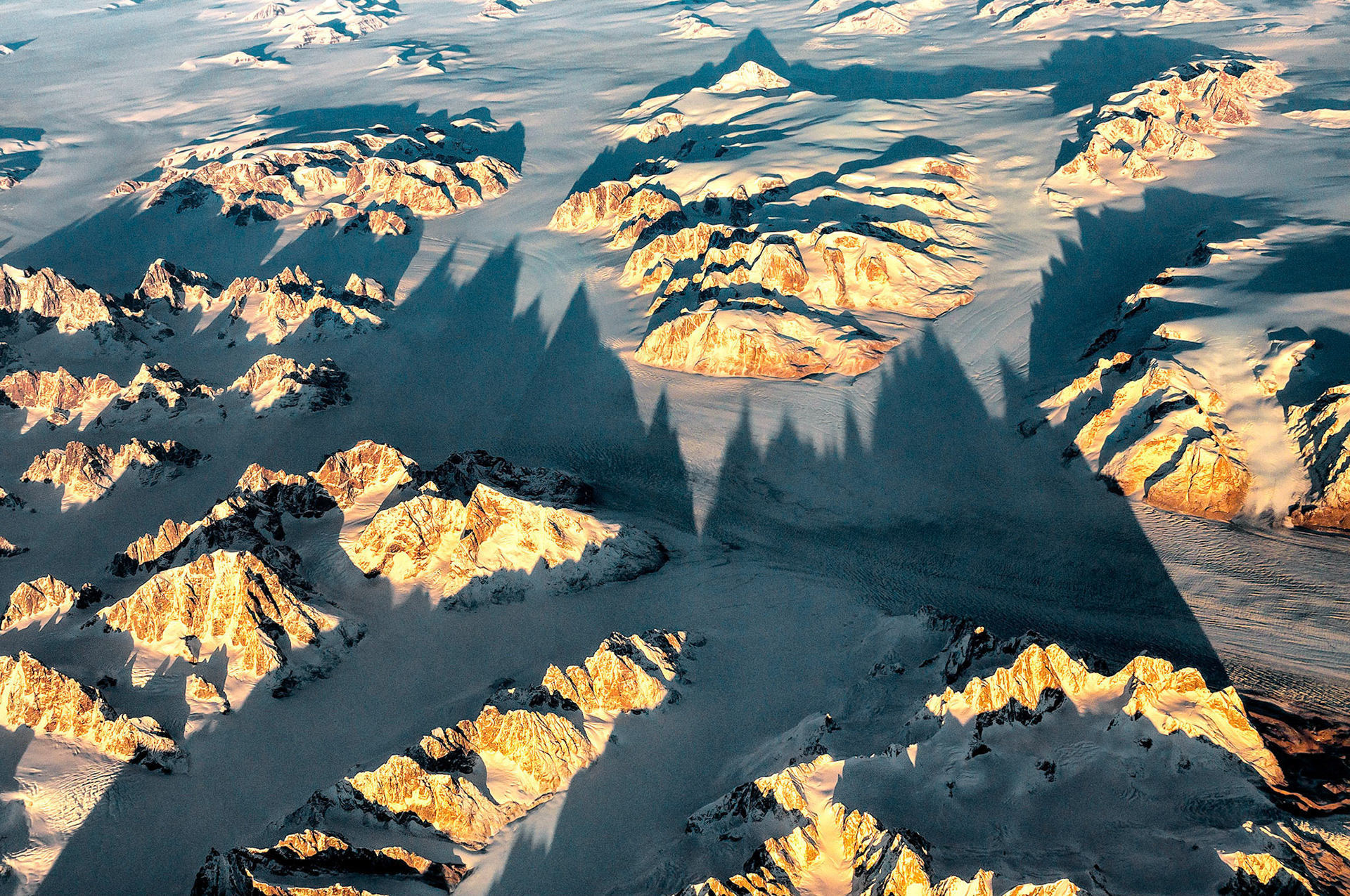
As the evening sun catches the tips of high mountain peaks in eastern Greenland, long shadows are cast over the vast, frigid landscape.
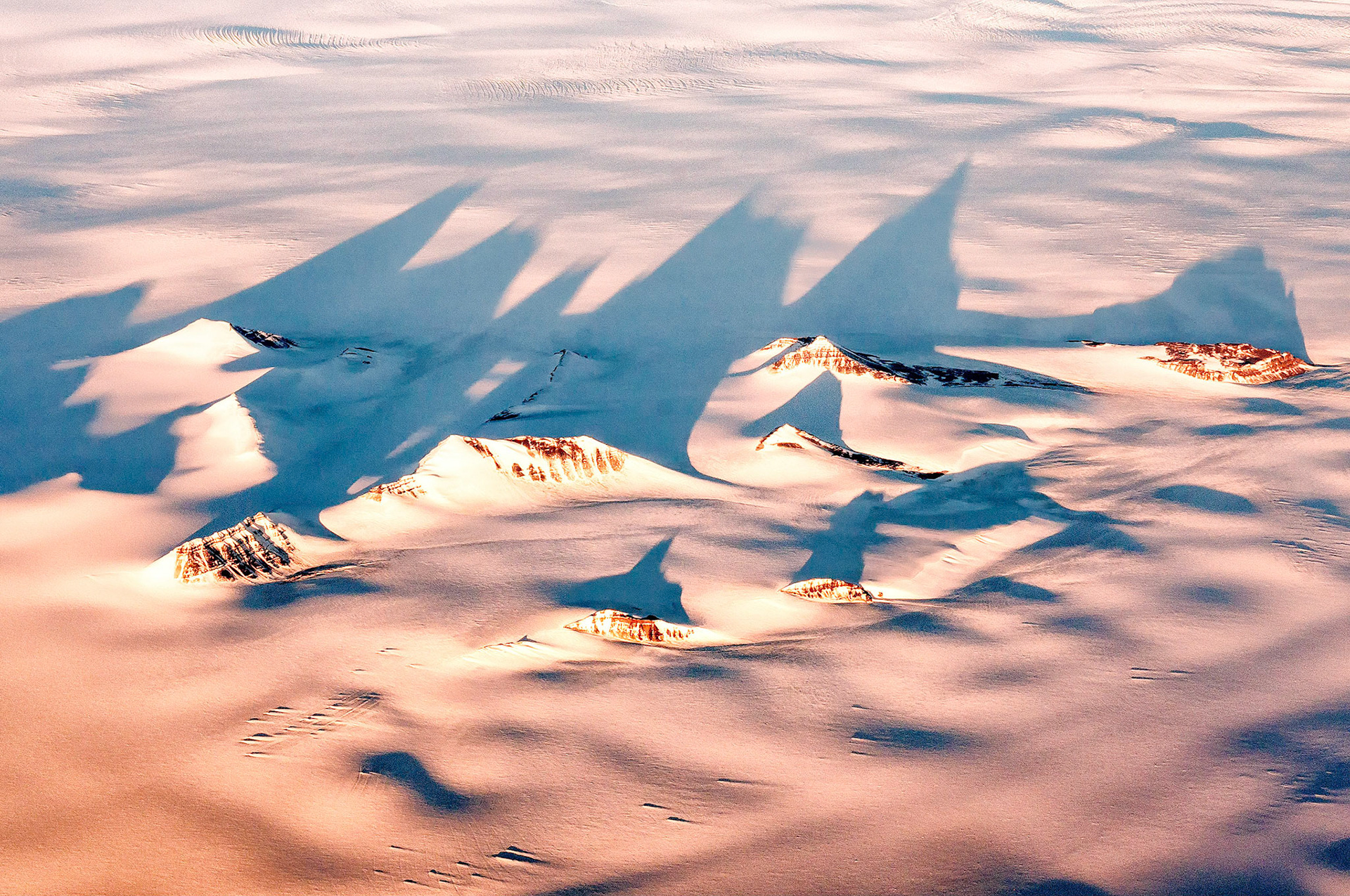
The dramatic ridges lines of these tall mountains cast their long shadows over rugged glacial terrain, somewhere over southern Greenland.
Mount Bierstadt, (14,065 ft = 4,287m), located in the Chichago Peaks of Colorado, USA, was named after Albert Bierstadt, a famed painter of western landscapes in the 1860s. Pine beetles have damaged some trees in the foreground forest adding to the vibrant autumn colors showing in the meadows and on the hillsides below the peaks.
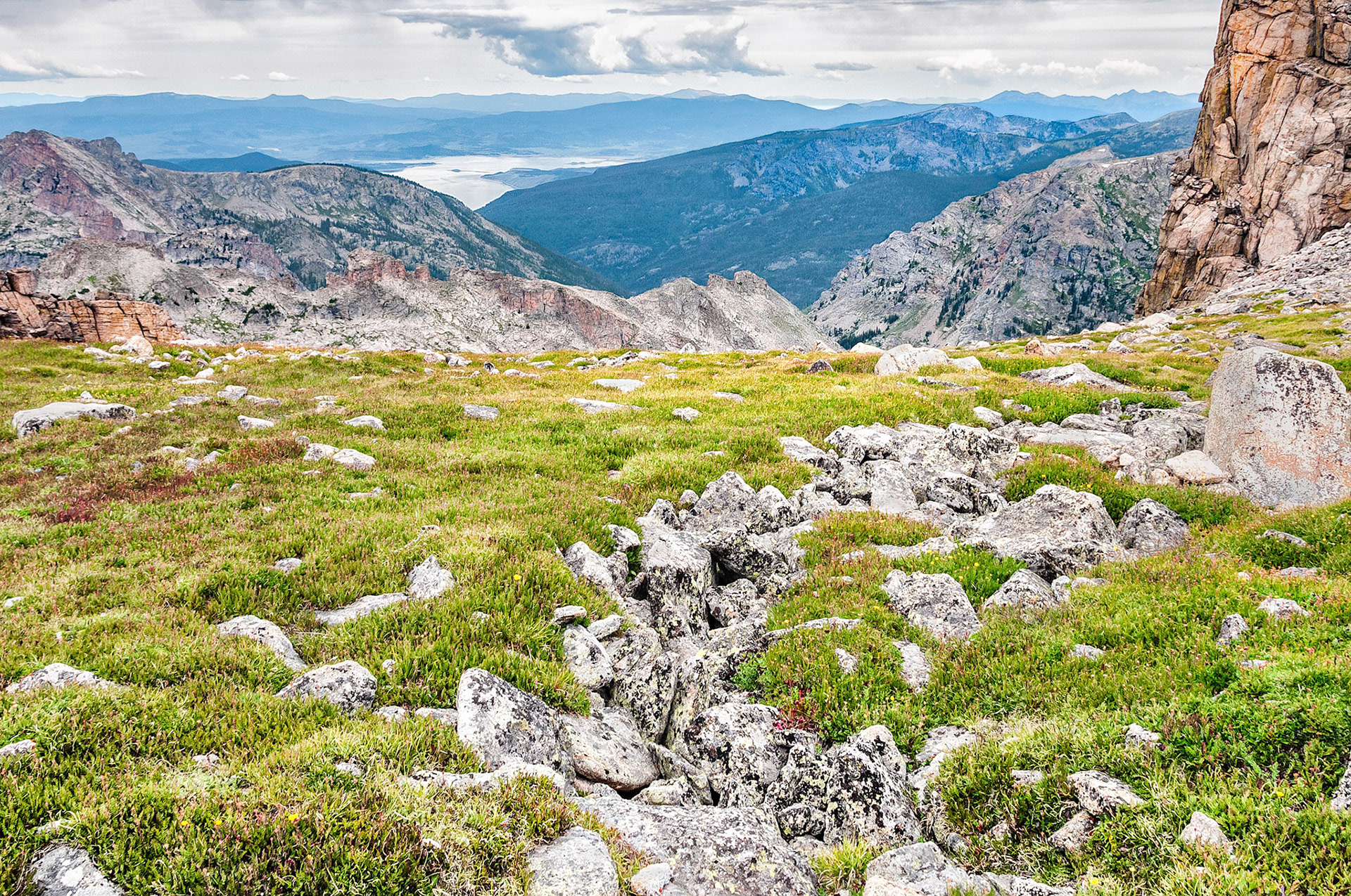
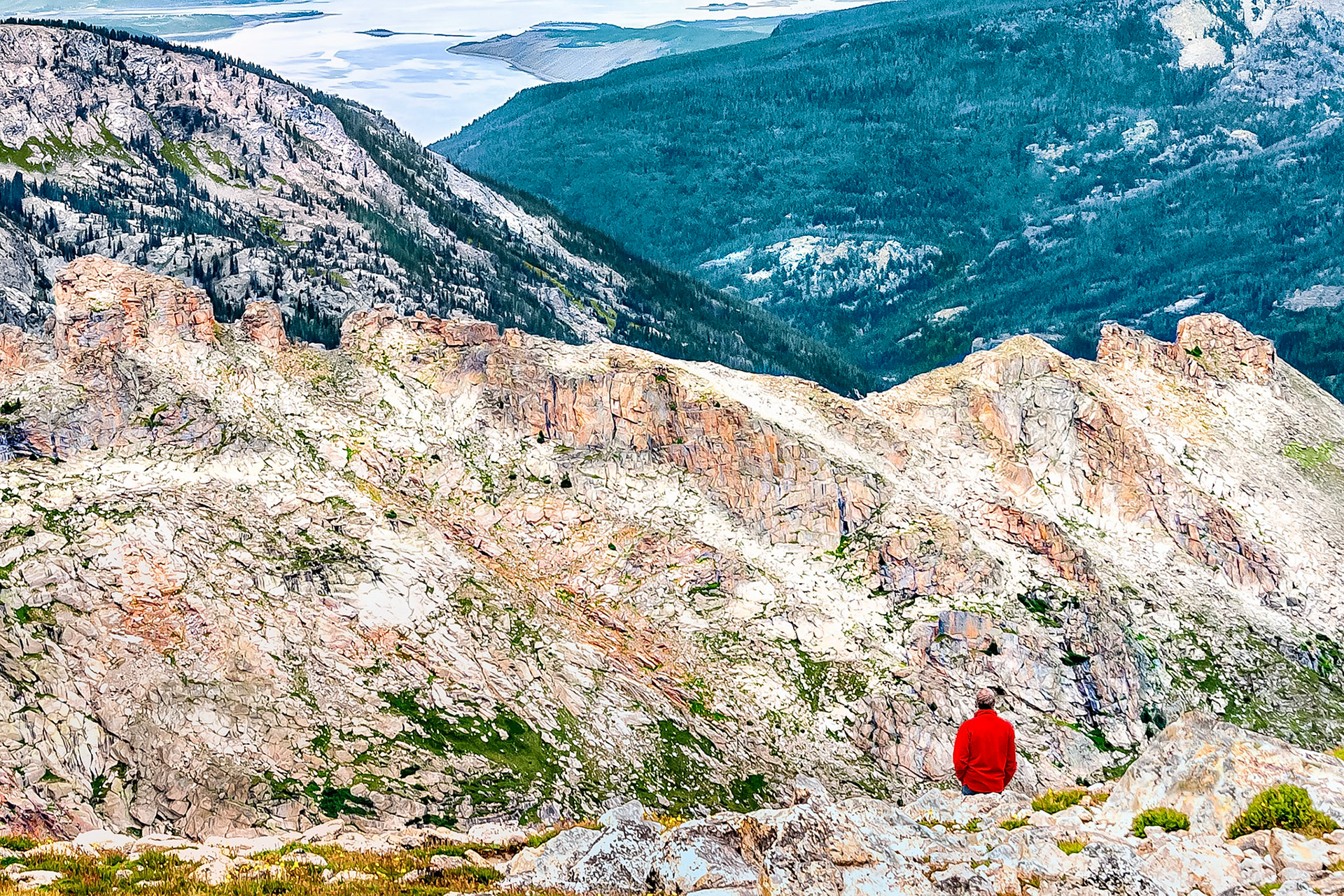
Grand Lake, the largest natural lake in Colorado, USA, (at 8,369 feet = 2,551 m), shimmers in the distance under cloudy skies. Also viewed here, is the tundra and scree terrain at Pawnee Pass, (12,542 ft = 3,823 m), on the Rocky Mountain Continental Divide in the Indian Peaks Wilderness Area.
A hiker takes in the views from Pawnee Pass, (12,542 ft = 3,823 m), on the Rocky Mountain Continental Divide in the Indian Peaks Wilderness Area. Grand Lake, the largest natural lake in Colorado, USA, (at 8,369 feet = 2,551 m), shimmers in the distance under cloudy skies.
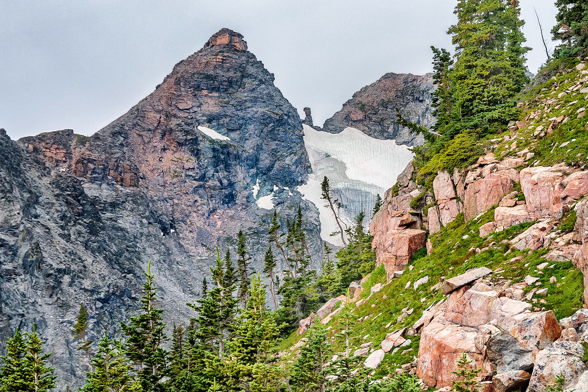
The rugged scenic terrain of the Indian Peaks Wilderness Area in the Roosevelt National Park of Colorado, USA, is dominated by a jagged skyline along the Continental Divide. Here, the Navajo and Apache Peaks on the ridge line stand witness to the power of glacial erosion and the passing of time. Remnants of a collapsed cornice form large icicles as the snow field above melts over a cliff face.
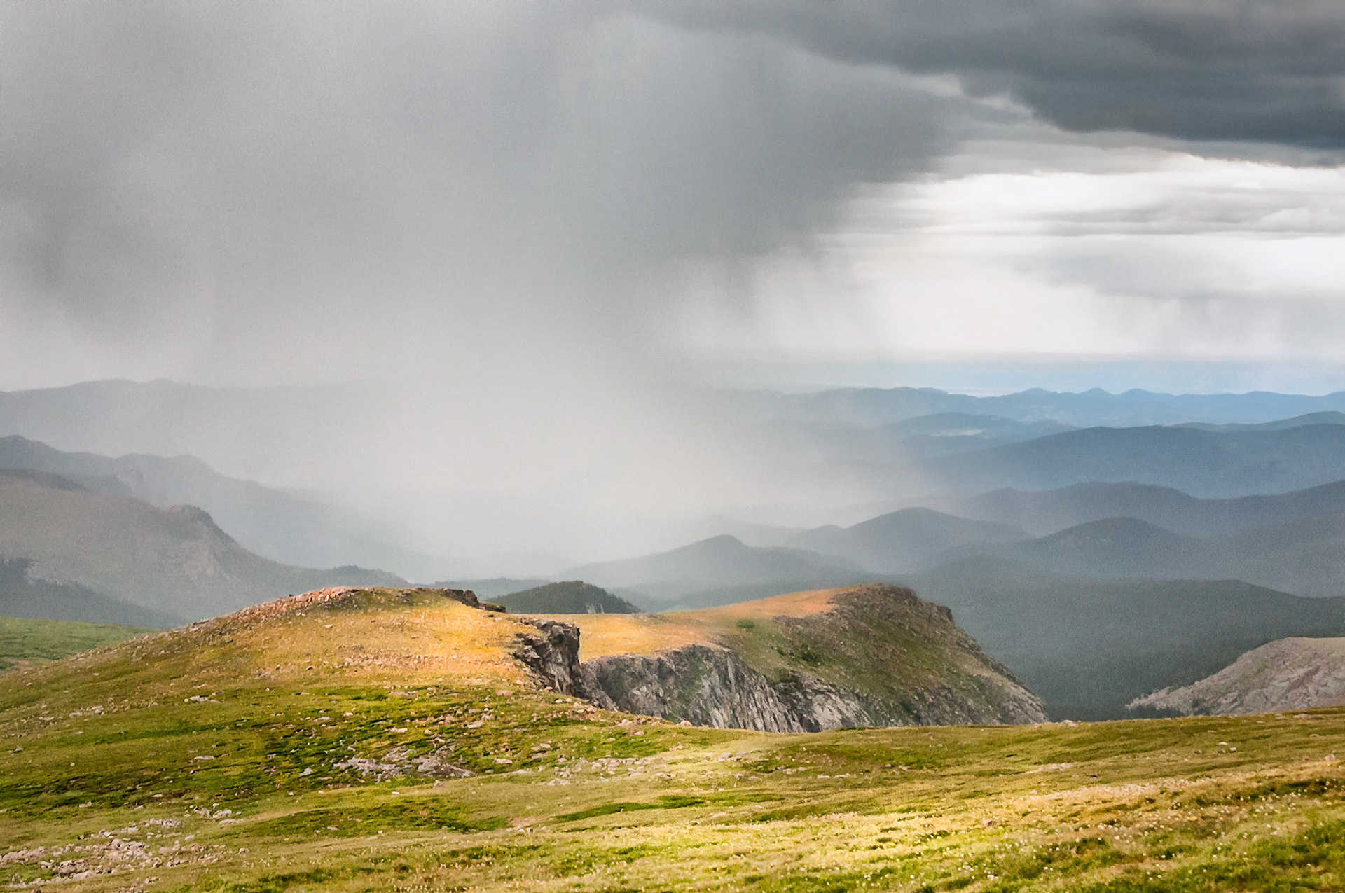
Sunlight filters through breaks in the clouds as an intense rain shower buckets down into the headwaters of Bear Creek in the Mount Evans Wilderness area near Denver, Colorado.
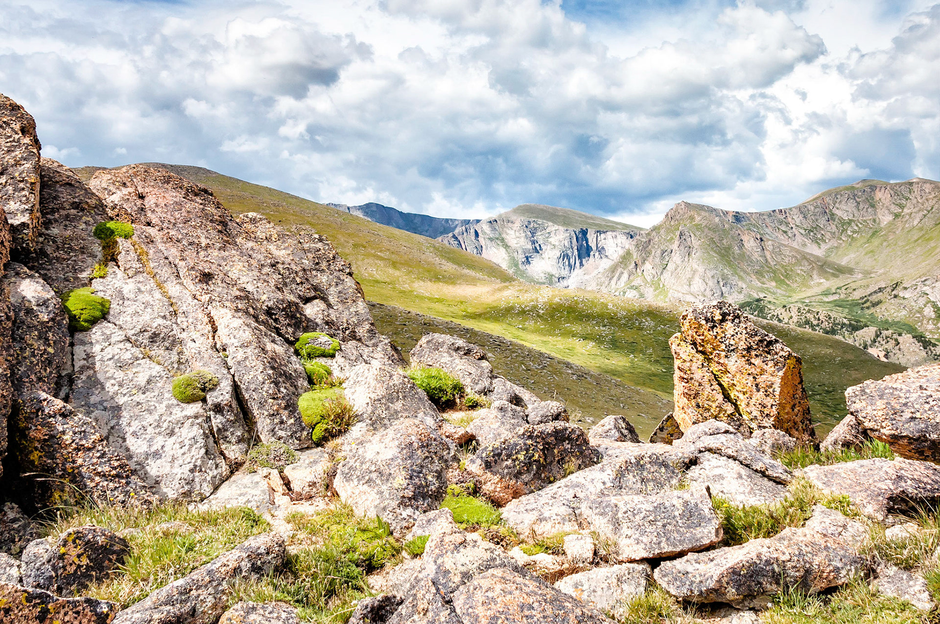
High above timberline, passing clouds cast their shadows over the tundra fields that undulate among the rocky cliffs of the Mountain Evans Wilderness Area near Denver, Colorado, USA.
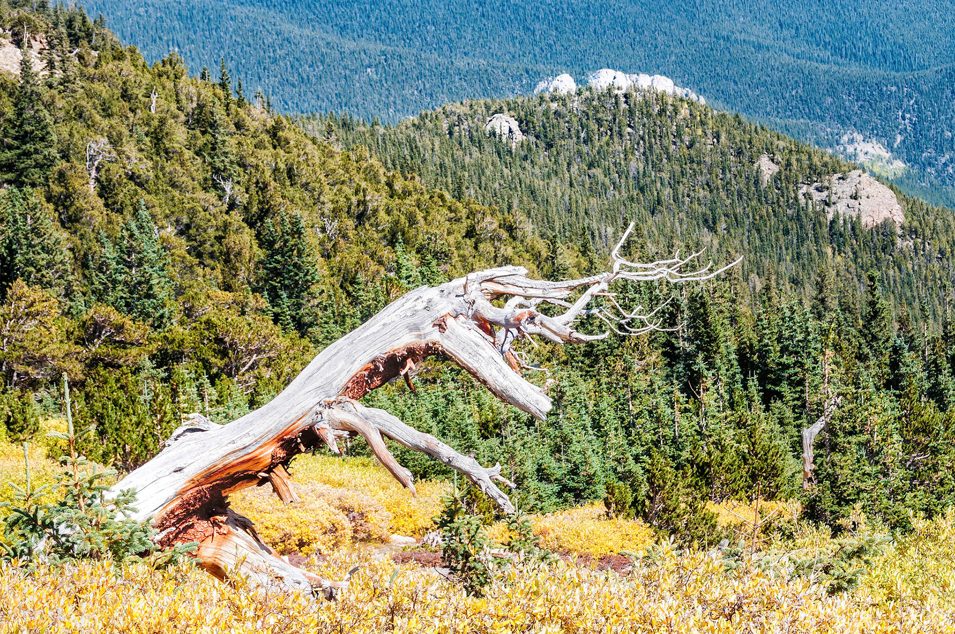
On the slopes of Mount Goliath in the Mount Evans Wilderness Area near Denver, Colorado, USA, the gnarled skeleton of a dead Bristlecone Pine tree stands where it has for many hundreds of years. Some of these trees at Mount Goliath are believed to be over 1,700 years old while some in California are over 3,000 years.
A slight breeze begins to disturb the reflections in the still waters of Summit Lake. Mount Evans, a 14,264 foot, (4,348 meter), high peak located west of Denver in Colorado, USA.
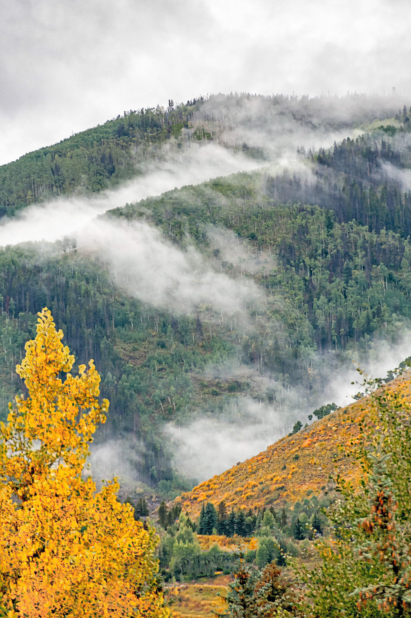
As winter approaches, Aspen trees and scrub oak brush on the hill sides begin to show their golden colours on a cloudy day in the high country near Vail, Colorado, USA.
Tree tops glow as they catch the setting sun in Yosemite Valley, California. These trees stand in a striking silhouette on the gigantic granite walls that were carved by glacial action.
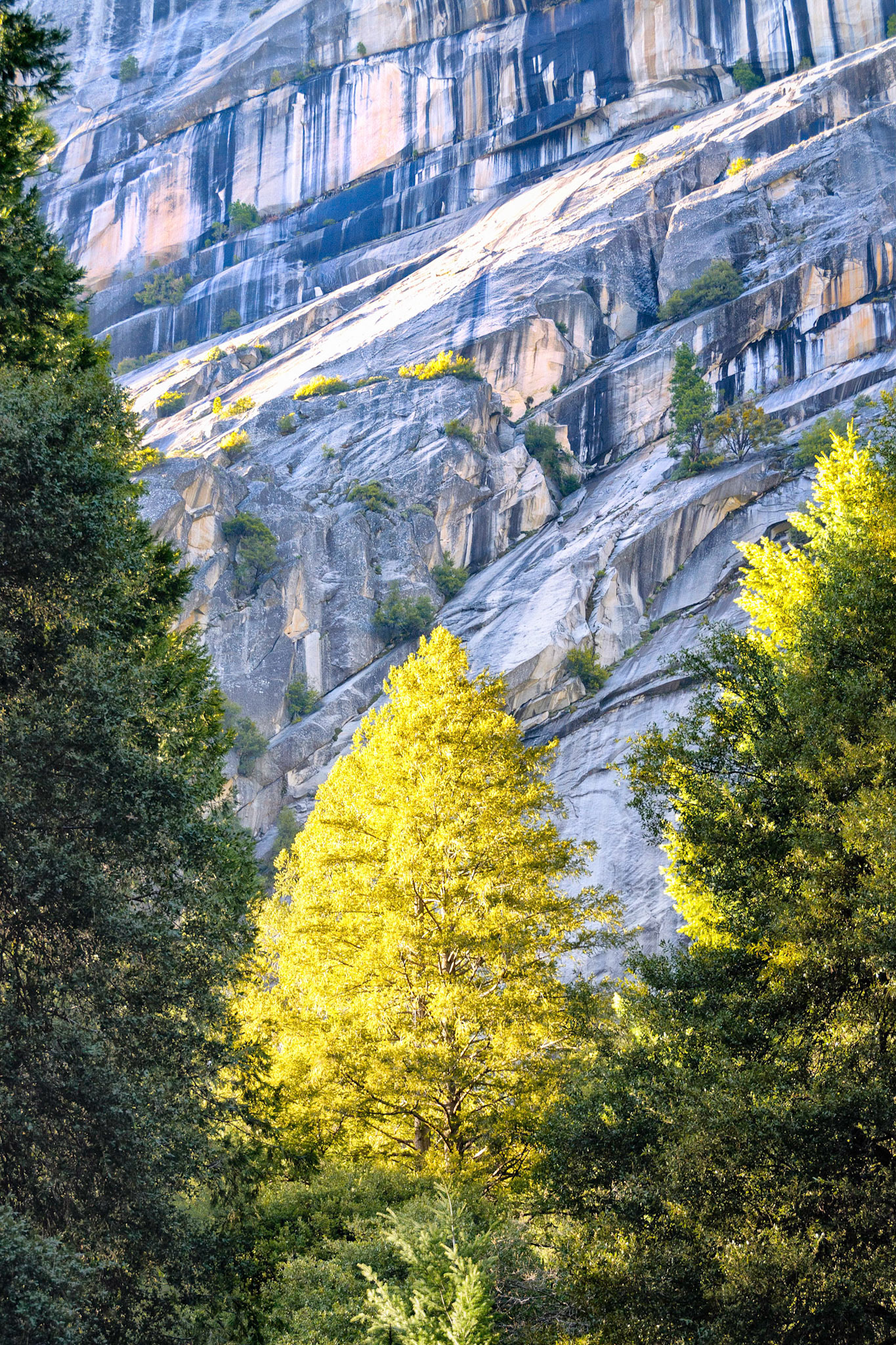
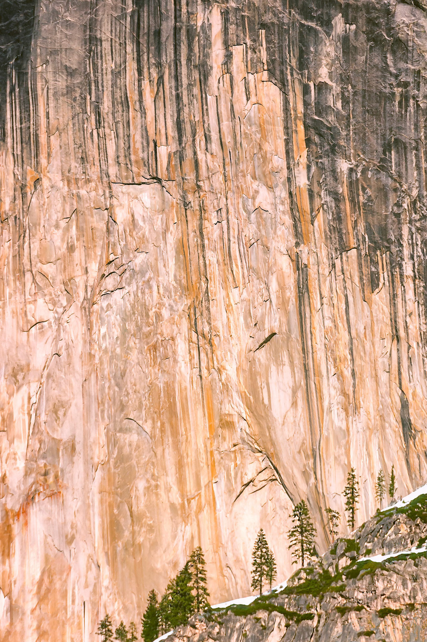
Mature pine trees are dwarfed by the sheer granite cliffs of Half Dome in the Yosemite Valley, giving a sense of scale to the massive rock walls. The spring time evening sun casts a rich glow on the awe inspiring cliff face.
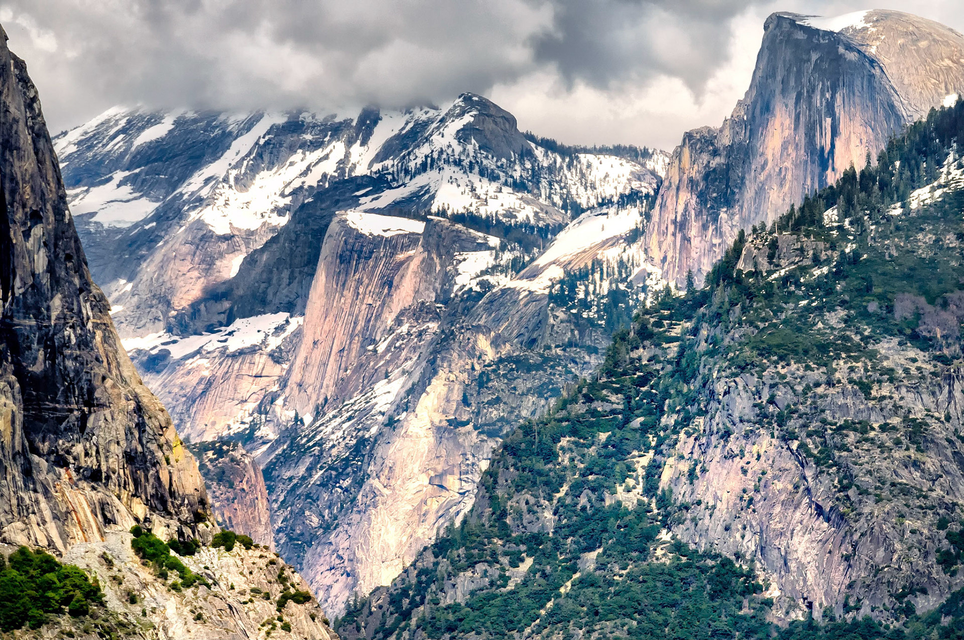
A gloomy mood prevails in the Yosemite Valley of California, USA as storm clouds gather behind the iconic Half Dome. The Yosemite Valley was carved from granite rocks by glacial action that left these dramatic landscapes.
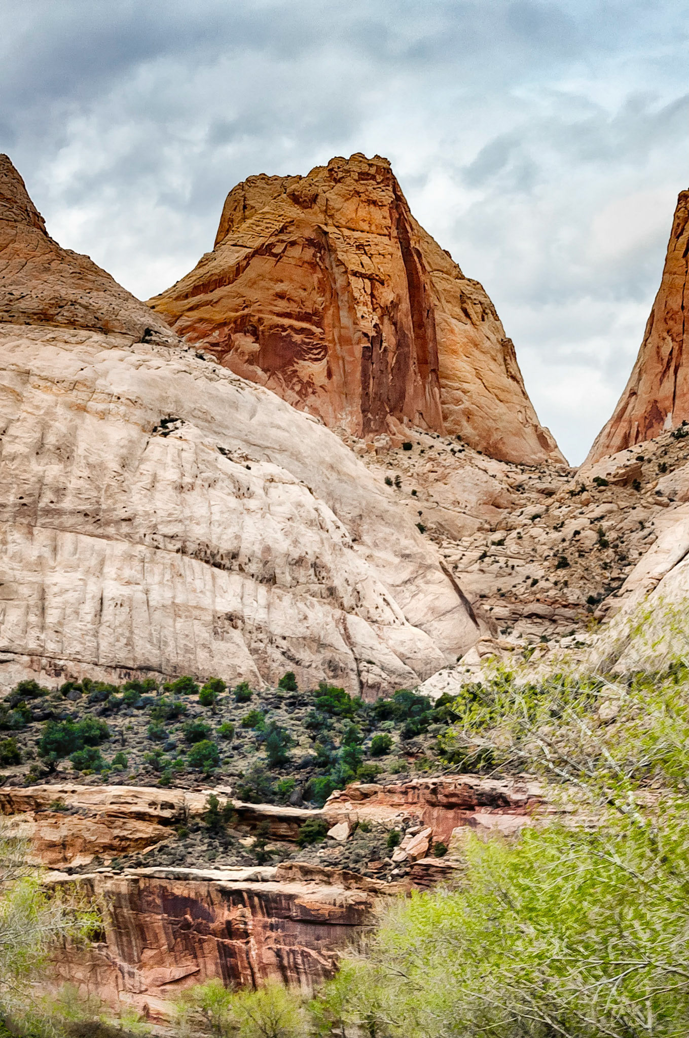
At left of this image is part of "Navajo Dome", one of the dramatic geologic features found in the Capitol Reef National Park, Utah, USA.. This park is so named for the white sandstone "domes" and cliffs of the Navajo sandstone formation that are reminiscent of the United States Capitol building in Washington, DC. Navajo Dome is the eroded remnant of buried ancient sand dunes that were cemented over time by minerals then subsequently, exposed by erosion over the past millennia.
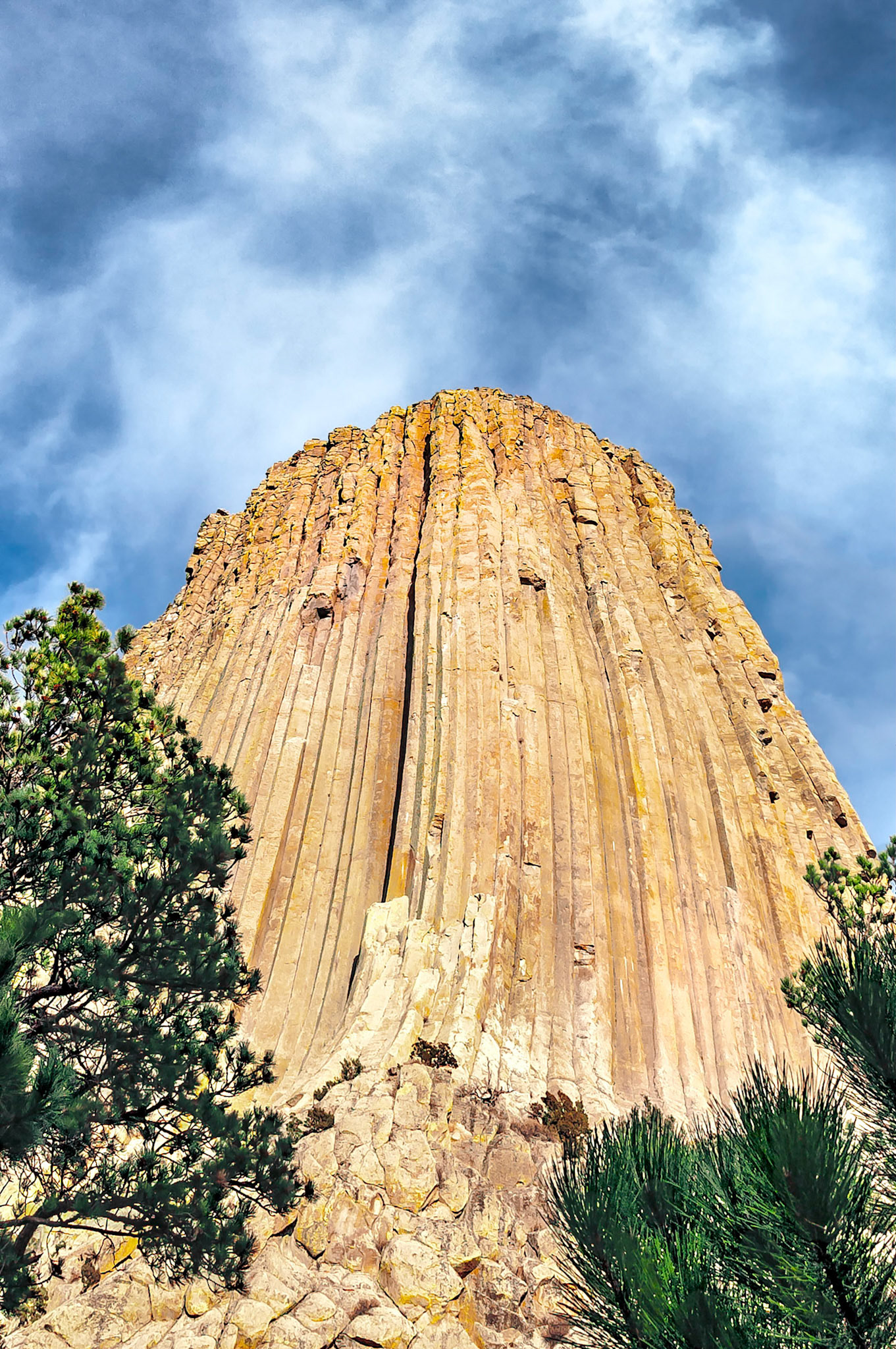
Devils Tower is located in north-eastern Wyoming and became the first National Monument in the United States, (1906). The formation is a volcanic intrusion that remains after surrounding sandstone layers eroded away. It rises 1,267 feet (386 m) above the Belle Fourche River and is popular with climbers. The tower is also a sacred site to many Native American tribes.
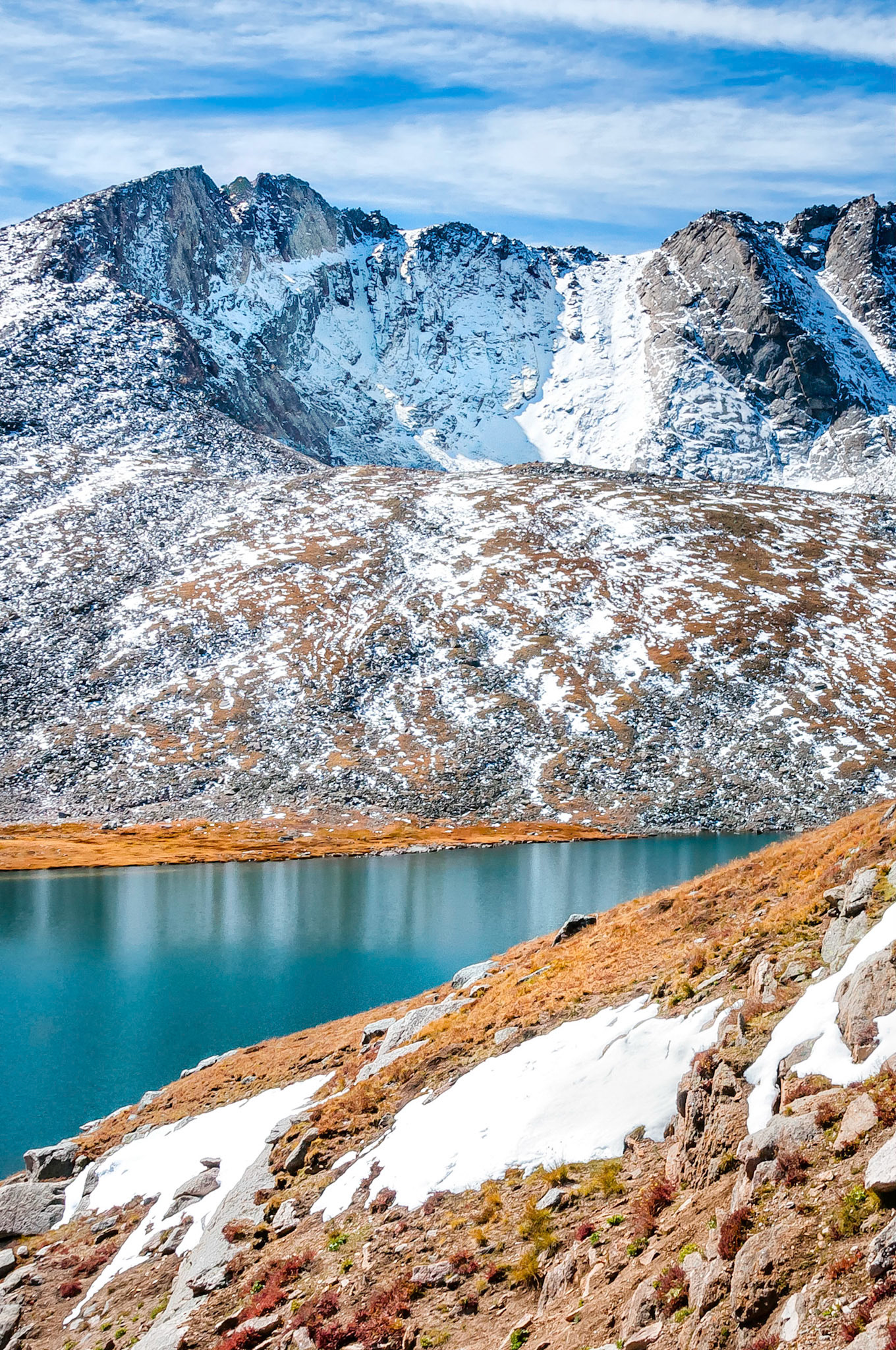
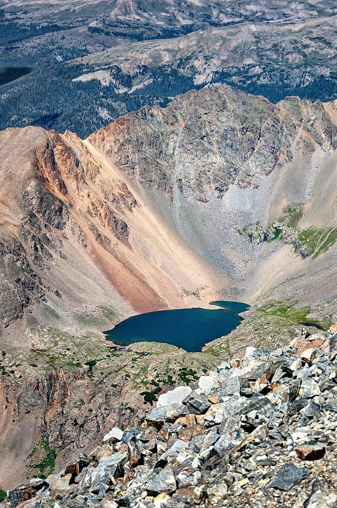
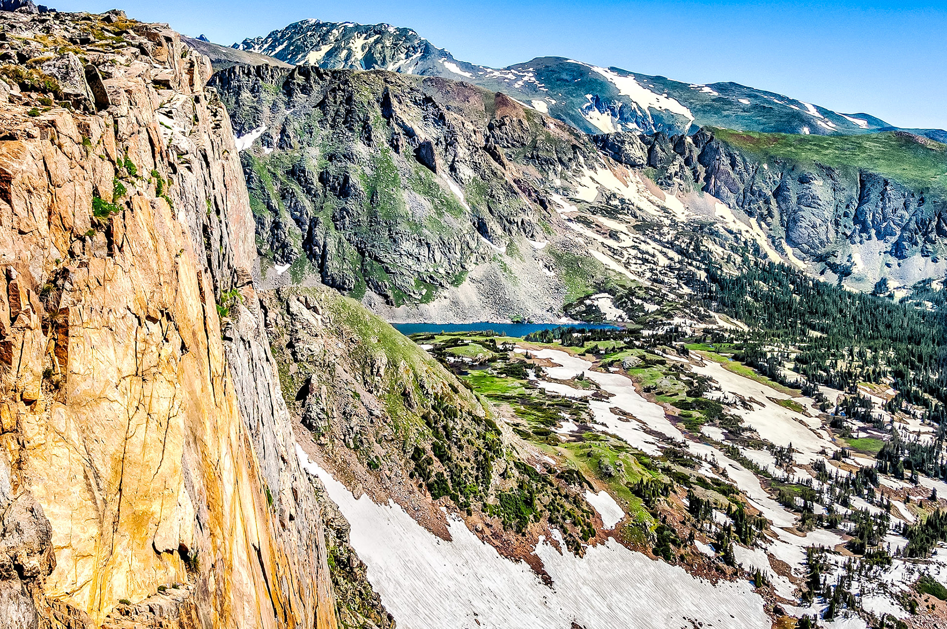
Chihuahua Lake, is a tarn lake (or corrie loch), formed by past glacial action. Resting at an elevation of 12,400 ft, (3,780 m), Chihuahua Lake is viewed here from the summit of Grays Peak, (14,270 ft = 4,350 meters).
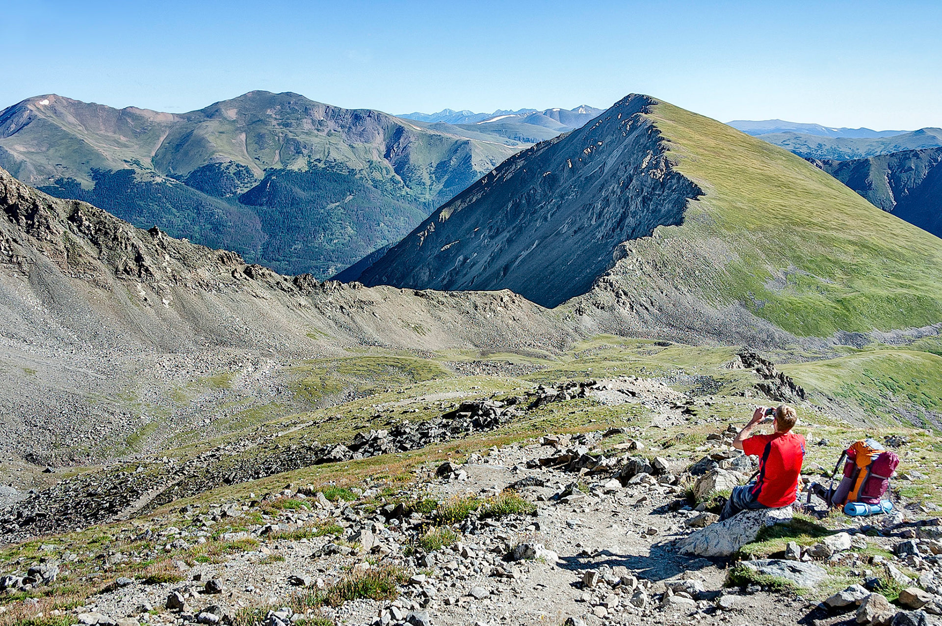
A hiker rests on the scree slopes of Grey's Peak, Colorado, USA and snaps a photograph of the Rocky Mountain terrain.
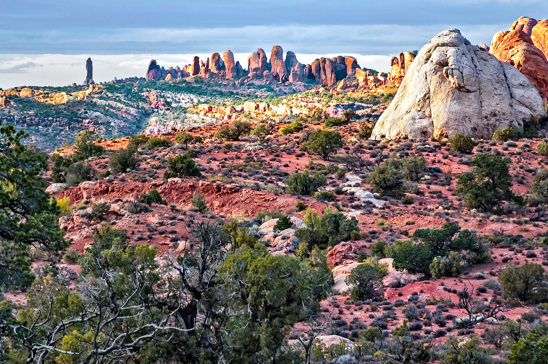
As dusk falls over the desert in the Arches National Park, Utah, USA, the sun illuminates the distant dramatic skyline of eroded sandstone features. A juniper pine near the end of it's life, struggles on in the arid terrain.
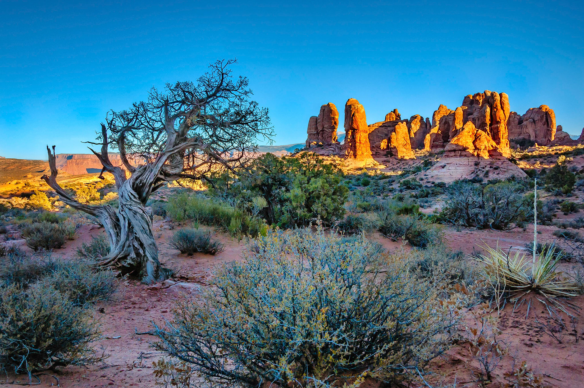
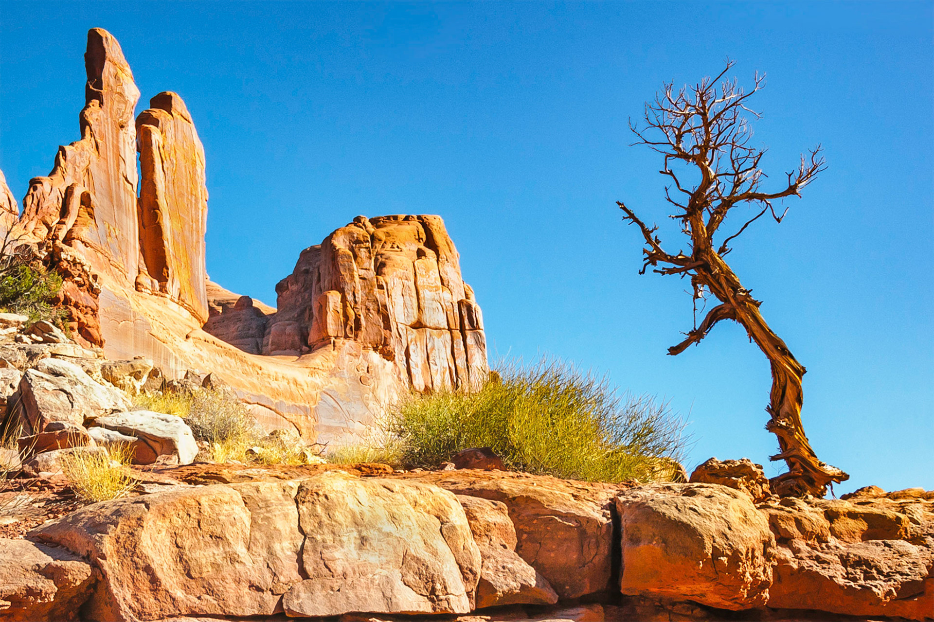
The skeletal remains of a pinyon pine still stand after a lifetime of enduring a harsh desert environment. The inspiring sandstone rock fins of "Park Lane" in the Arches National Park near Moab, Utah, USA glow in the afternoon sunshine against a clear blue sky.
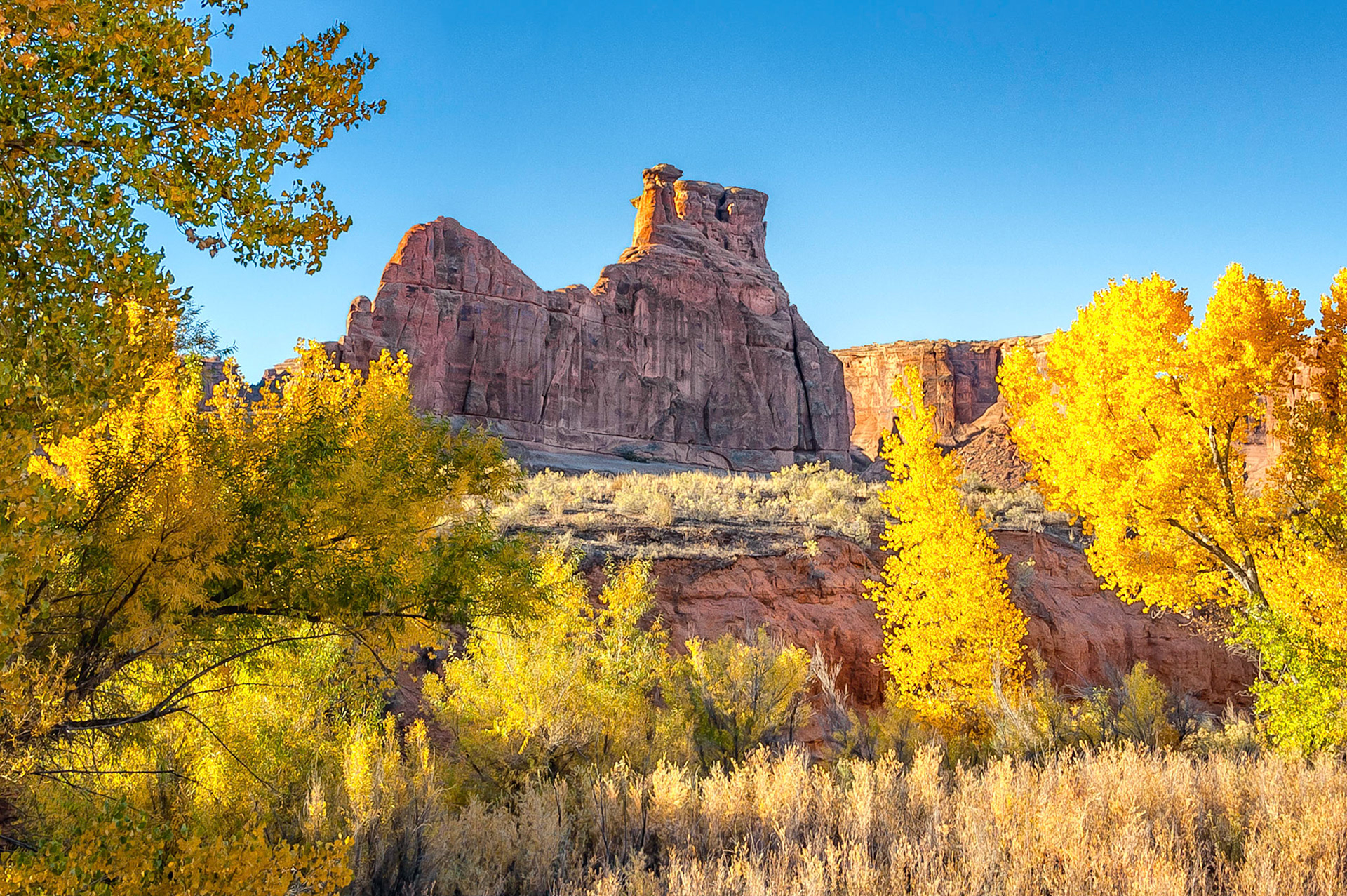
Early morning sunlight catches the edges of a sandstone fin formation, (known as the Tower Of Babel), and lights up the autumn leaves of trees growing along the Courtroom Wash in the Arches National Park, Utah, USA.
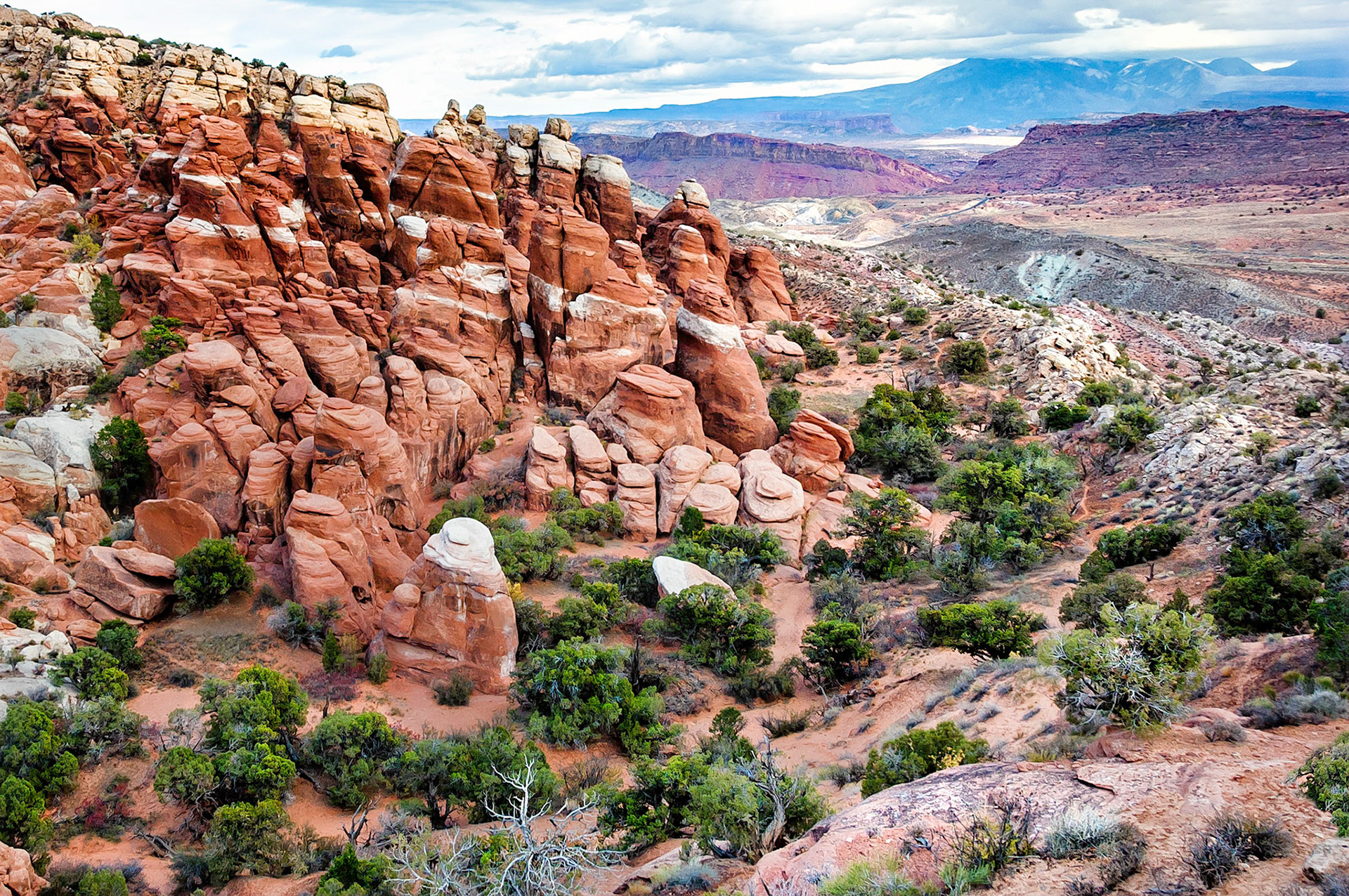
Views from the Fiery Furnace region of Arches National Park, Utah, USA, overlook the Salt Wash and beyond towards the distant, cloud coverd, La Sal Ranges. Juniper pines seek refuge from the harsh desert conditions along a sandy drainage line where at least a little moisture helps them survive.
The setting sun casts a rich glow onto the ancient eroded sandstone strata that comprise the complex geology found in Arches National Park near Moab, Utah, USA. Stunted Juniper Pines grow on the shallow red, rocky soils formed from the various sandstone and shale formations.
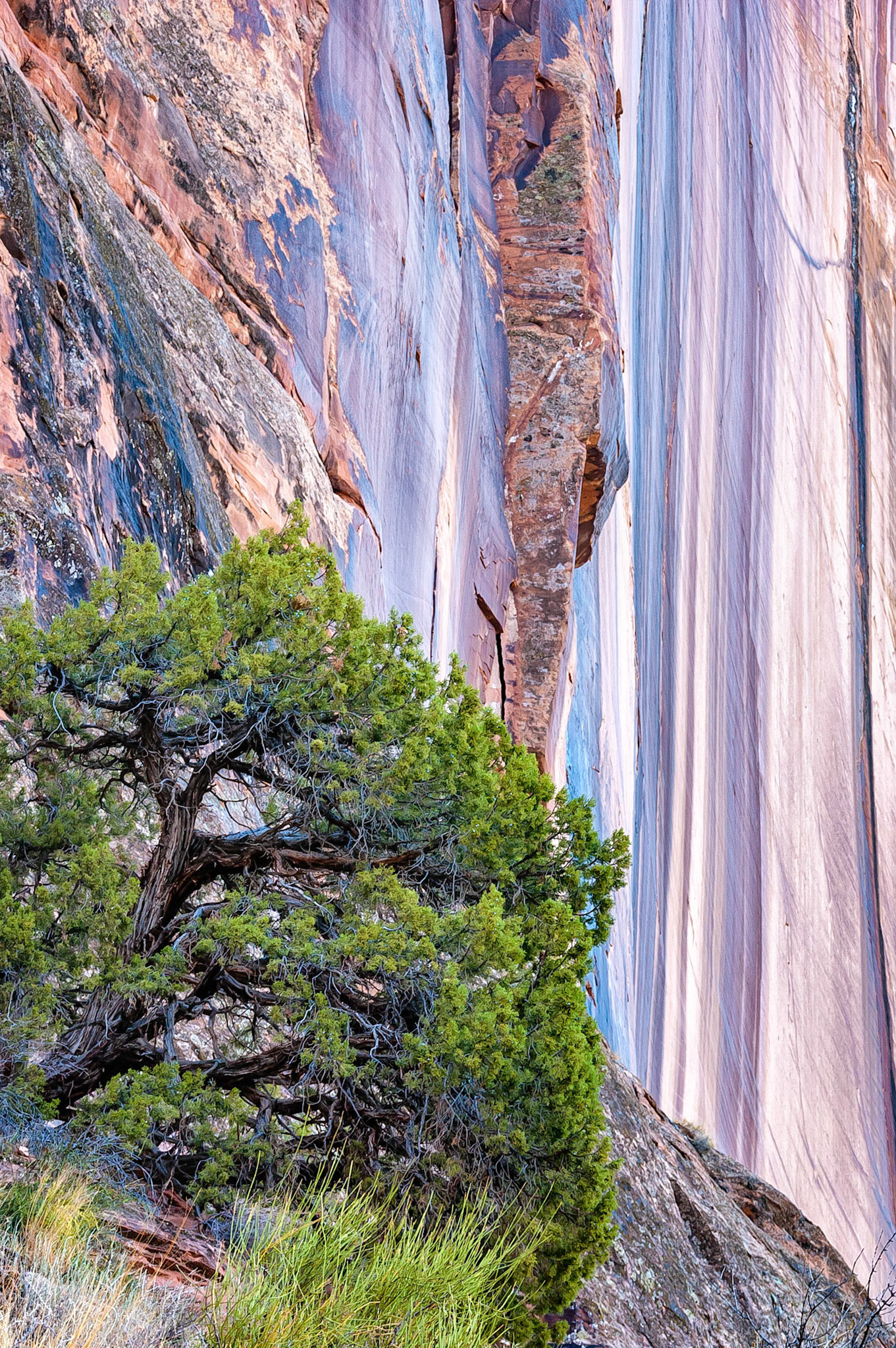
Clinging to life in an inhospitable environment, this hardy Utah Juniper tree survives beside a dramatic sandstone cliff face along the Colorado River near Moab, Utah, USA.
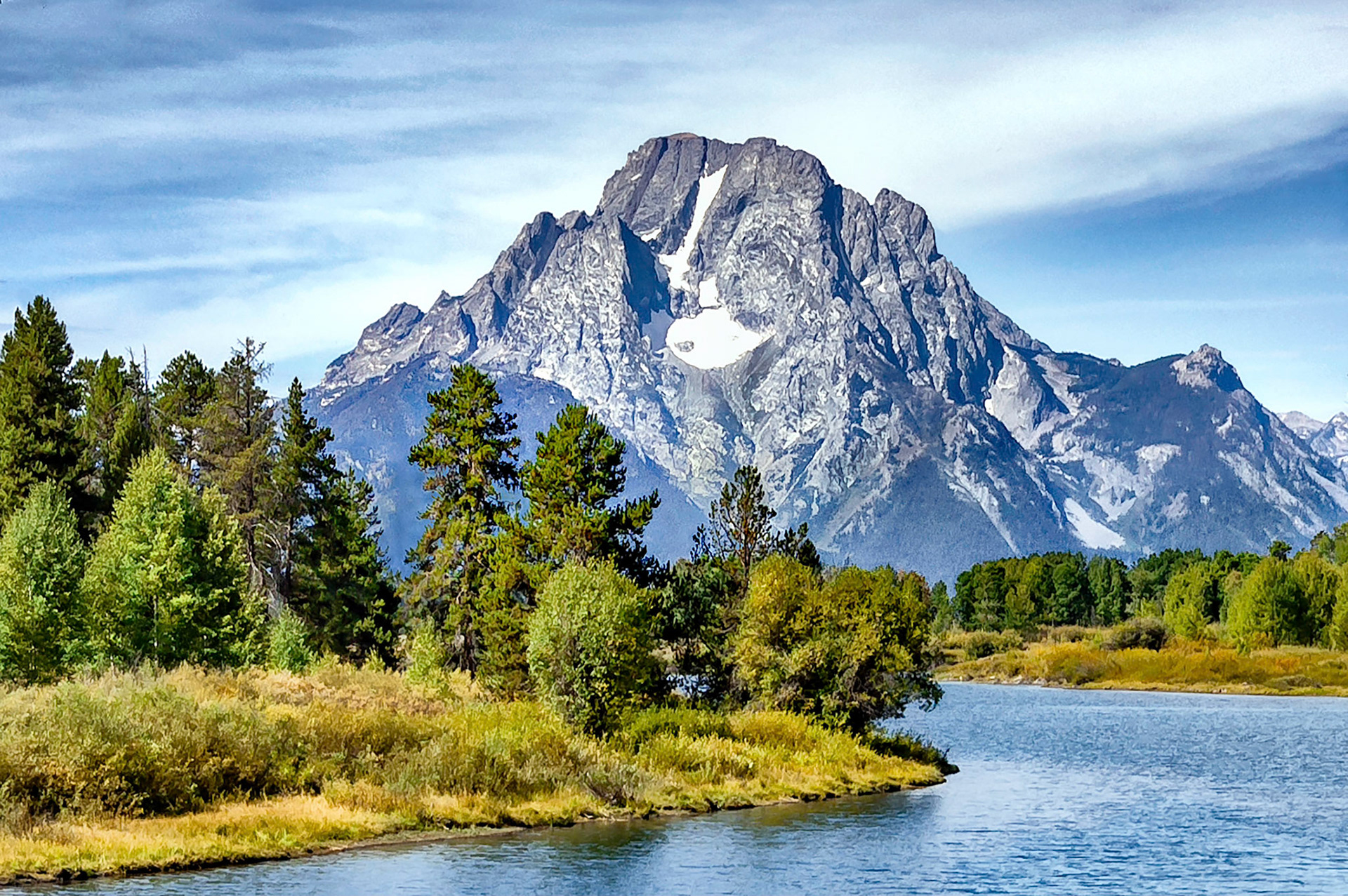
The Snake River winds across the plains below the iconic Mount Moran, (12,605 feet = 3,842 m). Mount Moran, named after the western artist Thomas Moran, lies at the northern end of the Teton Ranges in the Grand Teton National Park, Wyoming, USA.
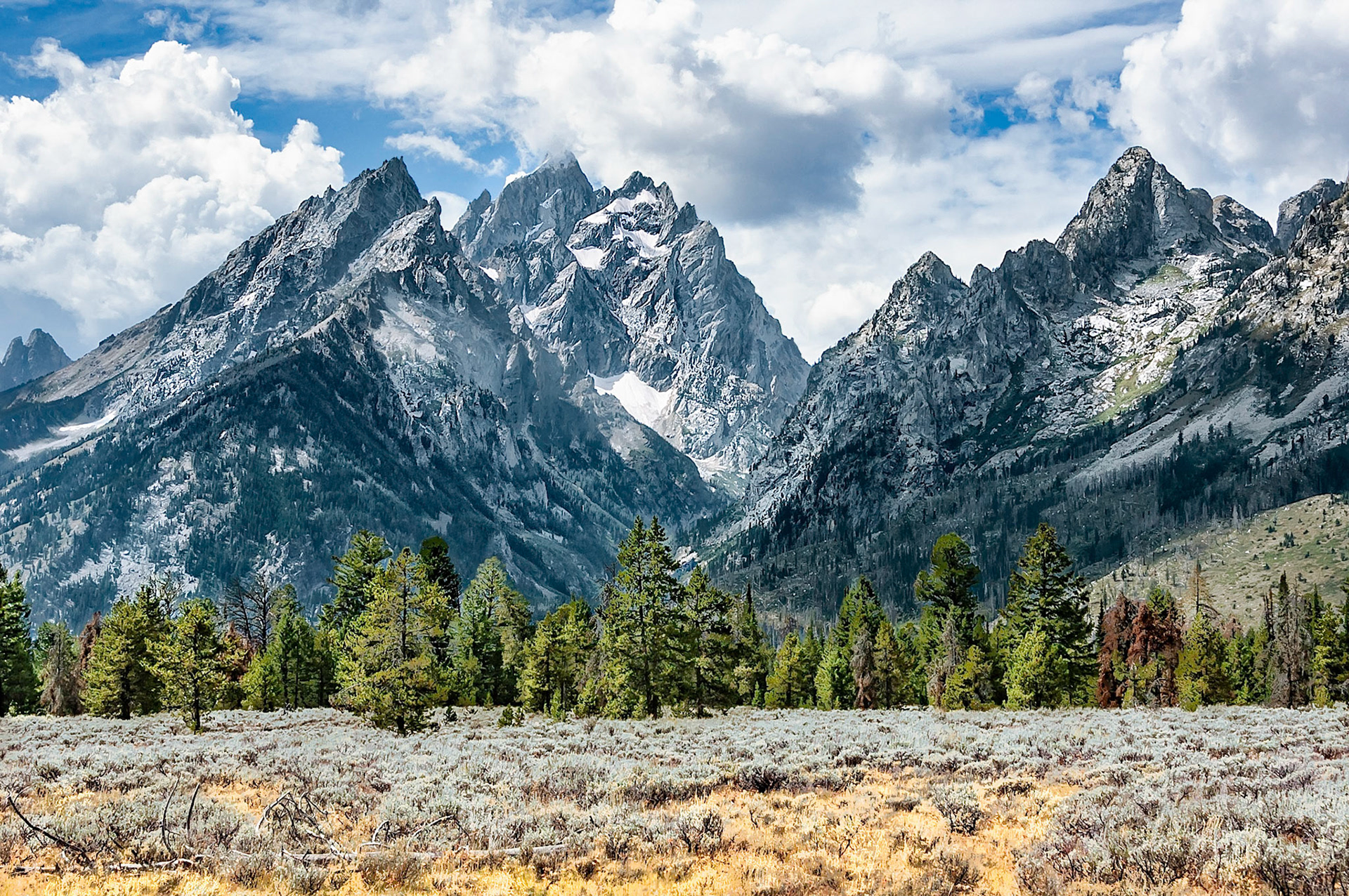
Passing clouds cast their shadows over peaks of the Grand Teton Ranges that arise abruptly and dramatically from sagebrush covered river flats near Jackson, Wyoming, USA. Grand Teton at 3,770 feet, (4,200 m), towers about 7,000 feet, (2130 m), above the valley floor.
Breathtaking mountain scenery is common when hiking along the Rocky Mountain continental divide. This view is near Rollins Pass, Colorado, USA. In the valley below, winter snows are melting and in the distance, Devil's Thumb Lake glistens in the bright spring sunshine.
Crystal clear snow melt waters collect in Lake Bob, a tarn lake formed in the ancient glacial moraine and scree rocks on the east side of the USA continental divide near Rollins Pass, Colorado.
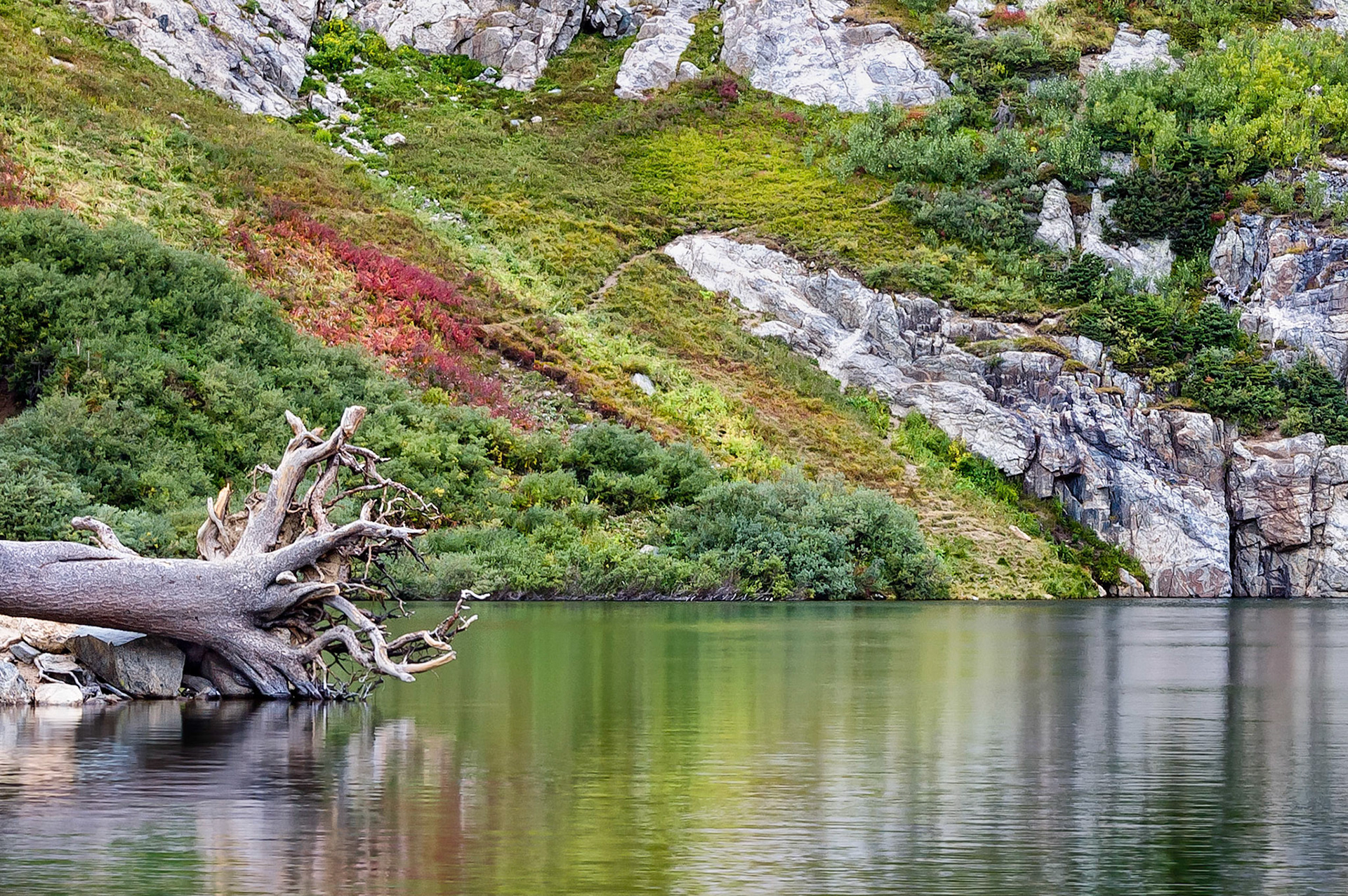
The trunk and tangled root mass of a fallen pine tree rests along the shoreline of Saint Mary's Lake at the base of Saint Mary's Glacier, Colorado, USA. A walking track leads up the rugged hillside through a mix of colorful autumn foliage reflecting in the lake's still waters.
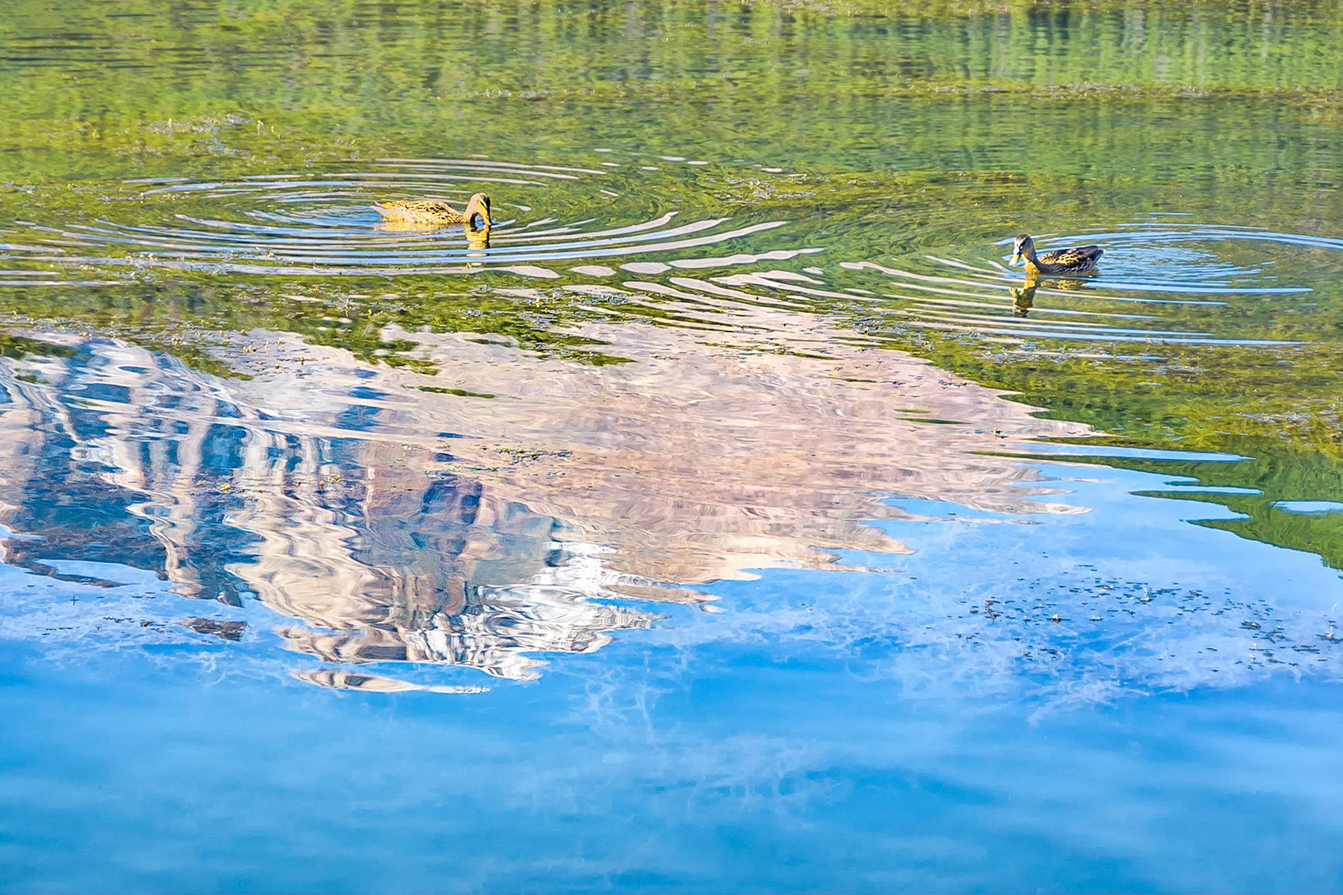
Female Mallard Ducks feed on the submerged grasses that grow in the shallow waters of Lake Lily near Estes Park, Colorado, USA. Here they paddle through reflections of the sky and pine forests overshadowed by nearby Longs Peak, (14,259 feet=4,346 m), in the Rocky Mountain National Park.
Taking in the views while hiking along the Contiental Divide near Berthoud Pass, Colorado, USA. Here, an early autumn storm has dusted the higher ridge lines with a light covering of snow.
A dusting of snow on the higher ridges near Berthoud Pass, (11,300 feet = 3,444 meters in Colorado, USA), signals the comming of winter to the Rocky Mountain high country. Rocky soils on ridges that are not favoured by the pine trees, support meadows of alpine grasses.
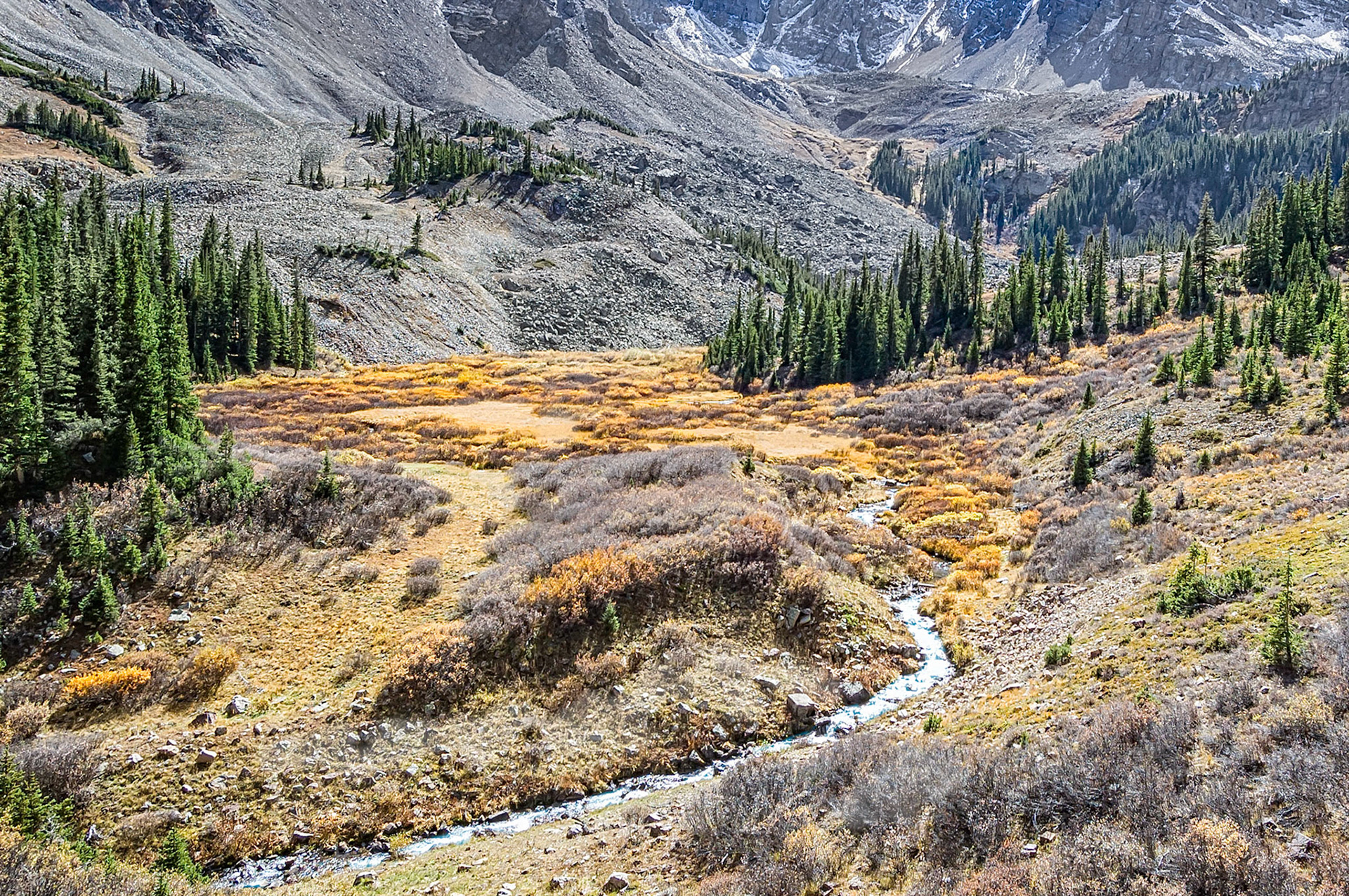
The waters of Pine Creek cut through a high mountain meadow below the scree slopes of Cathedral Peak in the Maroon Bells -Snowmass Wilderness Area near Aspen, Colorado, USA. The cooler autumn weather has turned the alpine willow shrubs and grasses a golden yellow.
Turning yellow, leaves of the alpine willow shrubs along the headwaters of Pine Creek, signal cooler weather conditions in the high country near Aspen, Colorado, USA. A ridge line leading to Cathedral Peak, makes a dramatic skyline beneath partly cloudy skies.
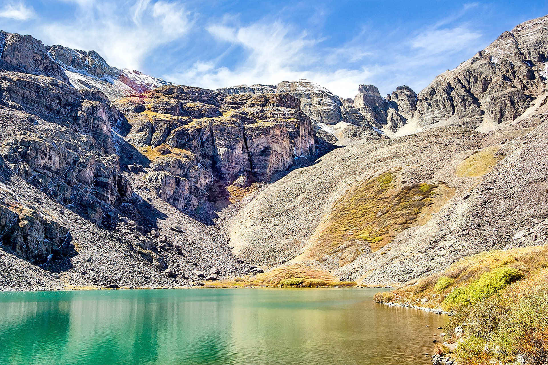
The clear waters of Cathedral Lake near Aspen, Colorado, USA, reflect rugged cliffs below a dramatic ridge line leading towards Cathedral Peak. (One can almost imagine two heart shapes in the image; one inverted heart in the partly cloudy sky above the ferruginous rock layers and yet another, formed by the scrub growing on the scree slope beyond the lake.)
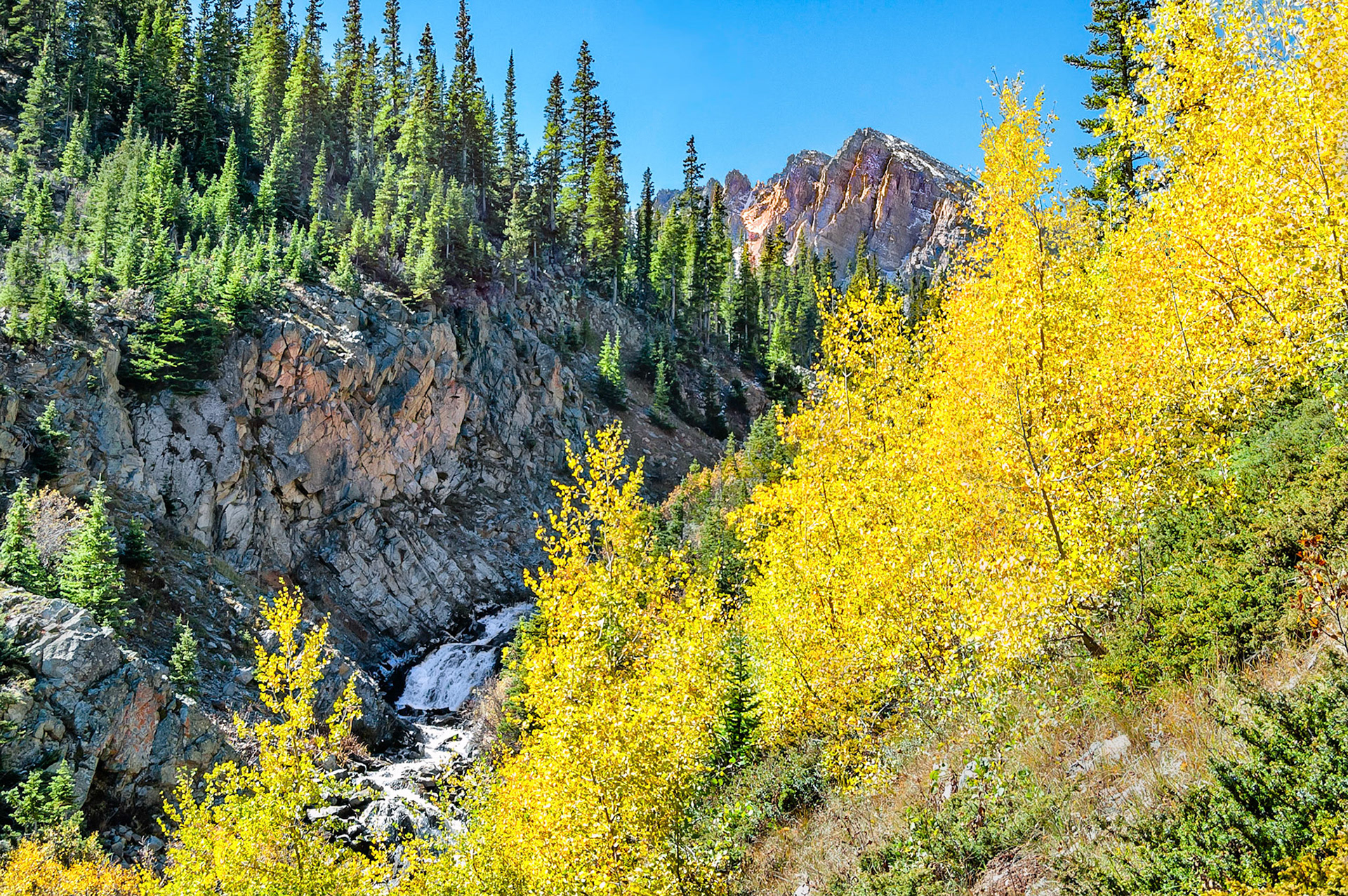
A hike along Pine Creek near Aspen, Colorado, USA, reveals striking views of ridge lines, rugged terrain, creeks and clear waters rushing over cascades. The yellow autumn foliage of Aspen Trees contrasts with the vivid blue Colorado skies. At the far end of the watershed, Cathedral Peak reaches into the sky.
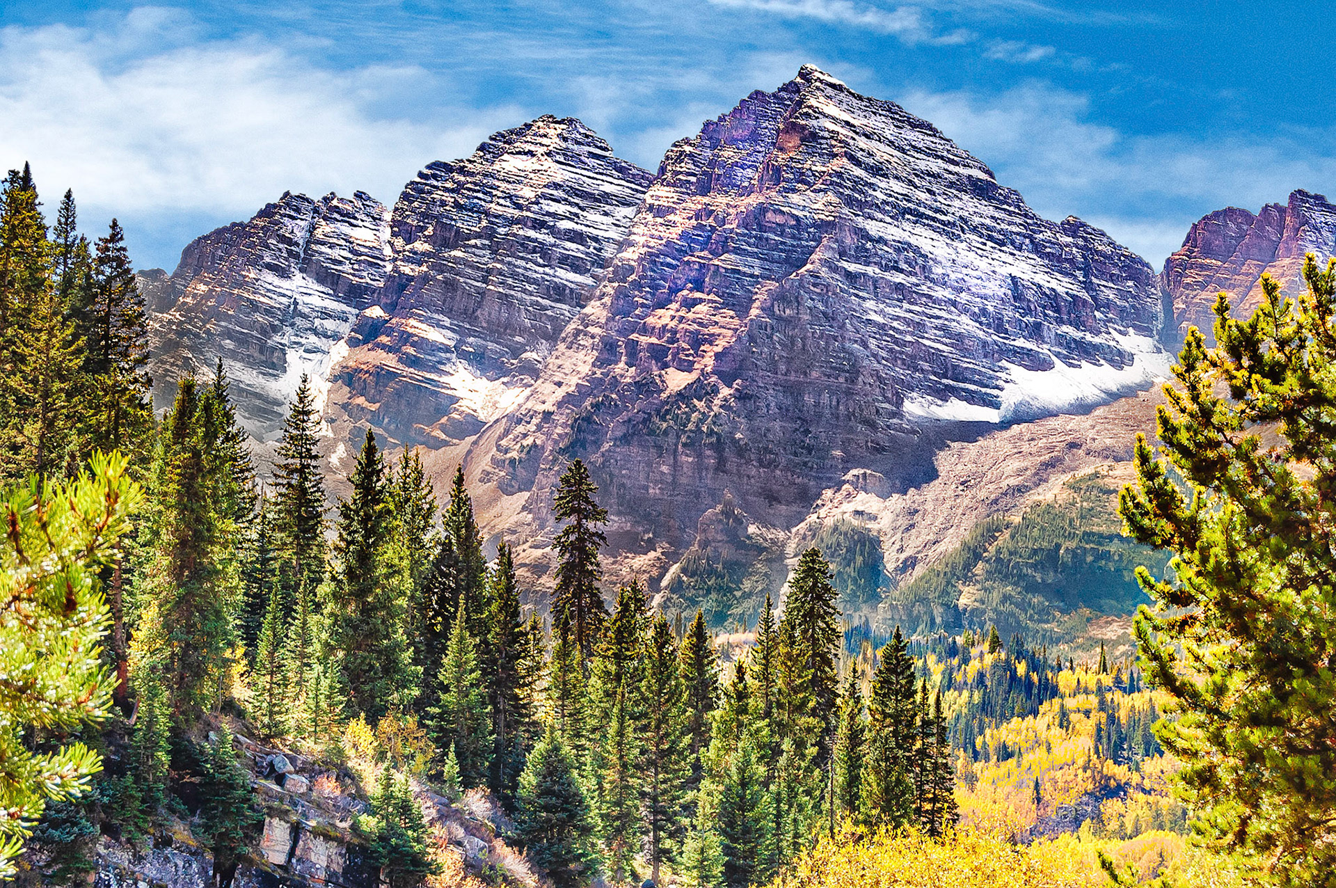
Named after their distinctive maroon colour, the Maroon Bells are iconic peaks in the Elk Mountains of Colorado, USA. The Bells were formed by glacial action on sedimentary mudstone deposits. The tallest, Maroon Peak, at 14,163 feet, (4,317m), is the 27th highest peak in Colorado.
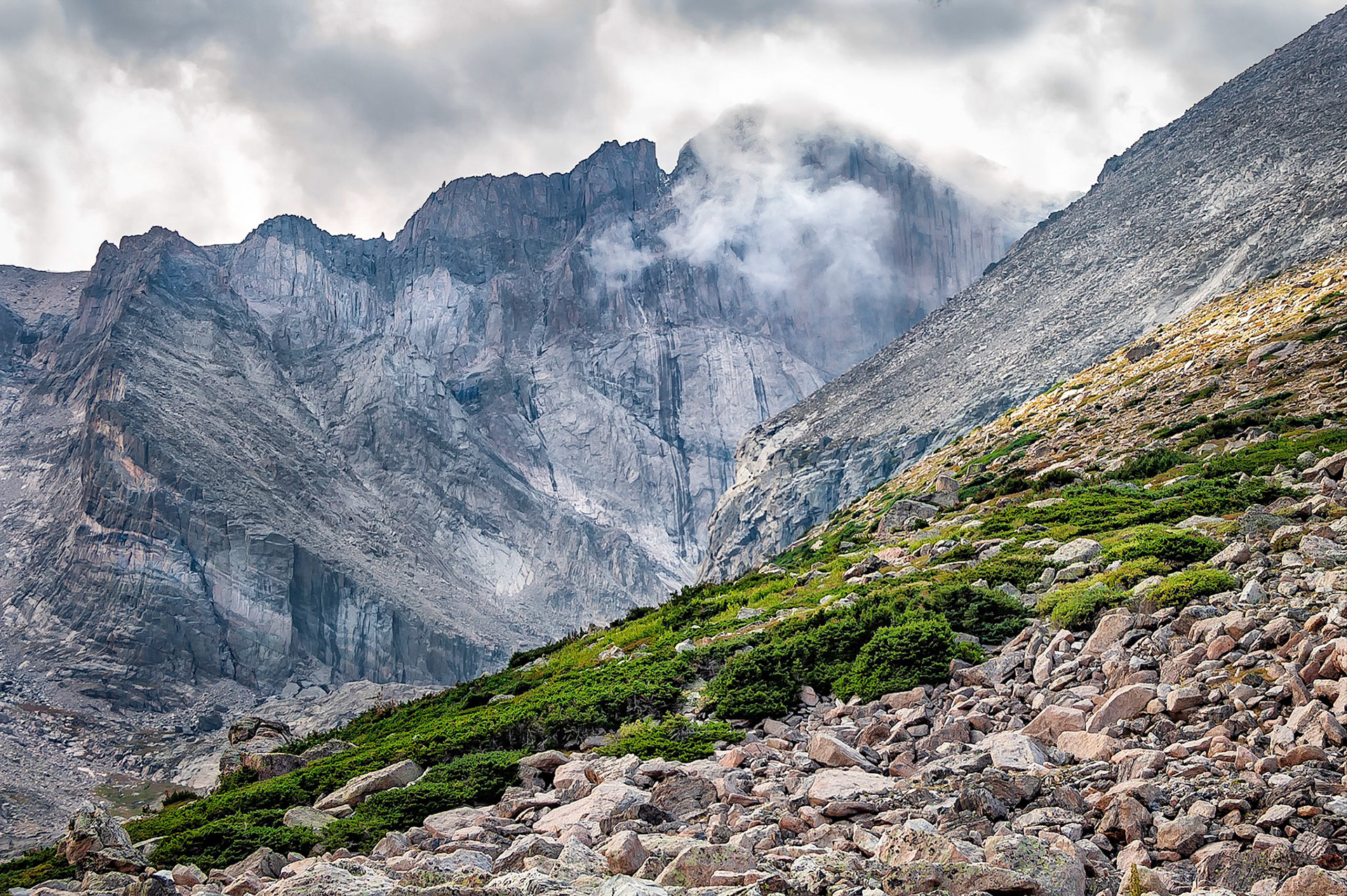
Weather changes quickly in the high country... clouds move onto the north face of Longs Peak, (14,259 feet=4346 m), in the Rocky Mountain National Park, Colorado, USA. The scree slopes of Mt Lady Washington are on the right.
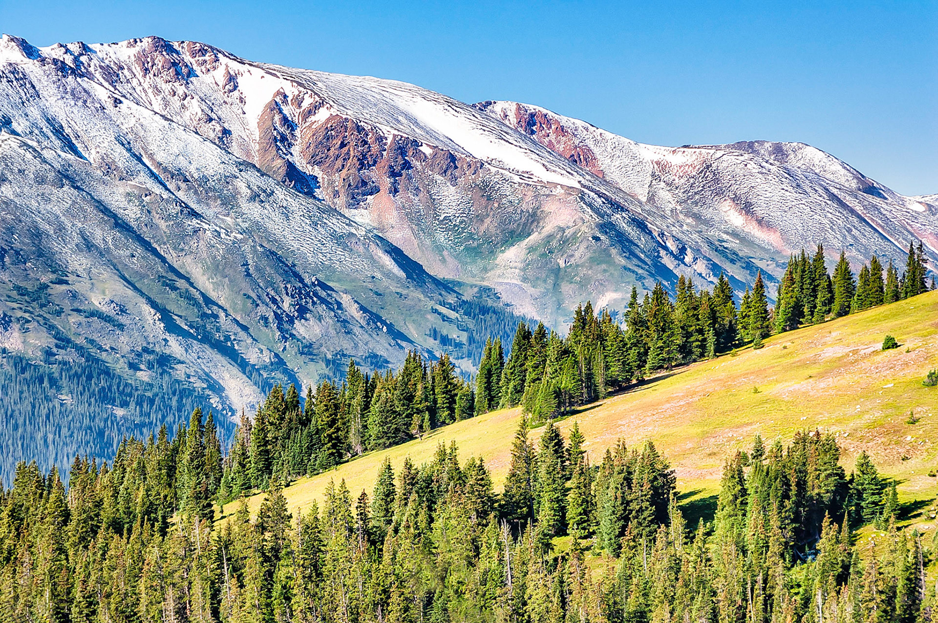
Runoff waters from recent rains in Colorado's Rocky Mountain National Park, cascade over a rocky ledge at Granite Pass. Grasses, burned by recent frosts, turn brown as shrubs begin to brighten with their autumn colors. Towards the west, the rugard skyline of the USA's continental divide rises above the valley floor.
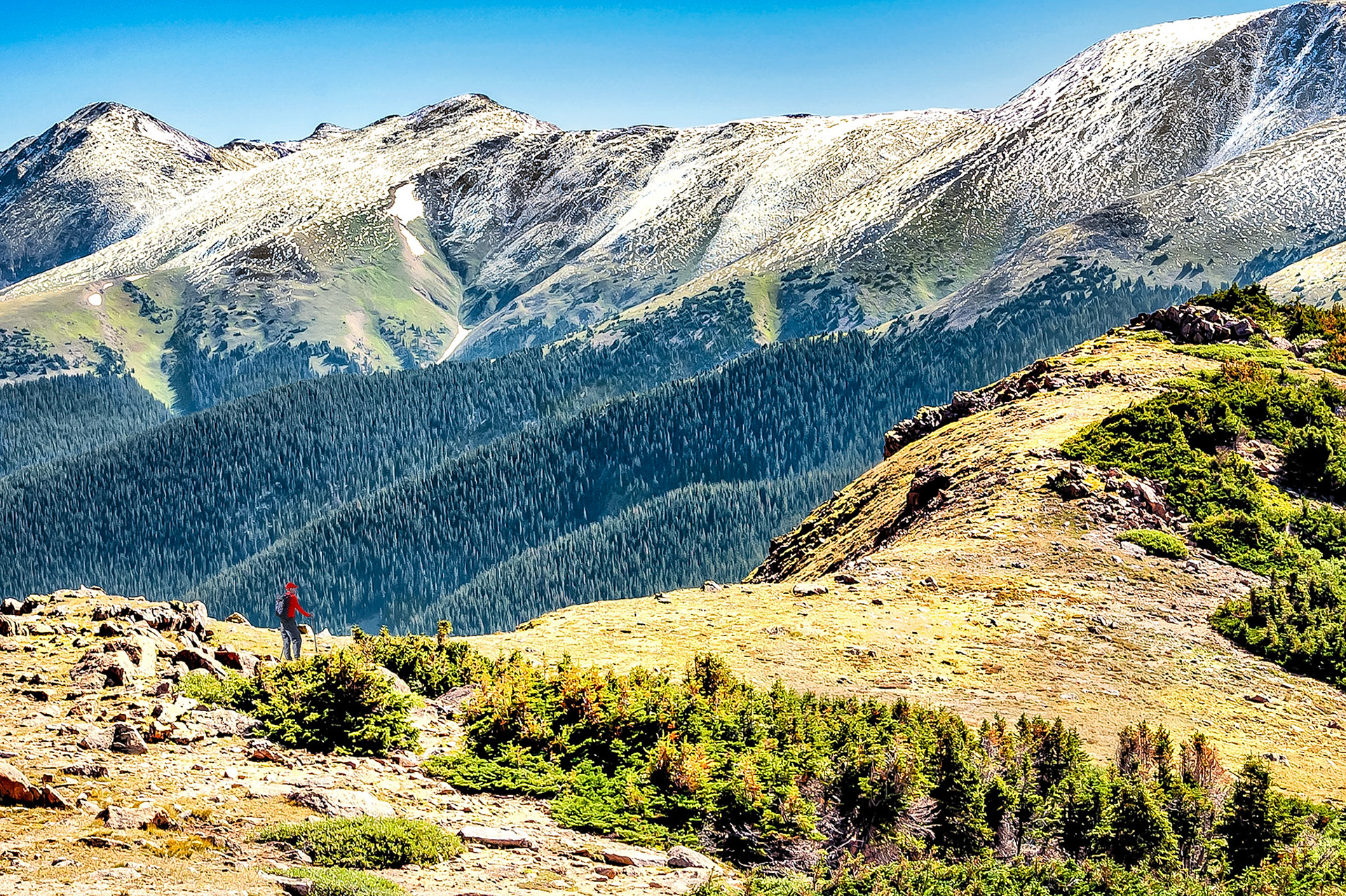
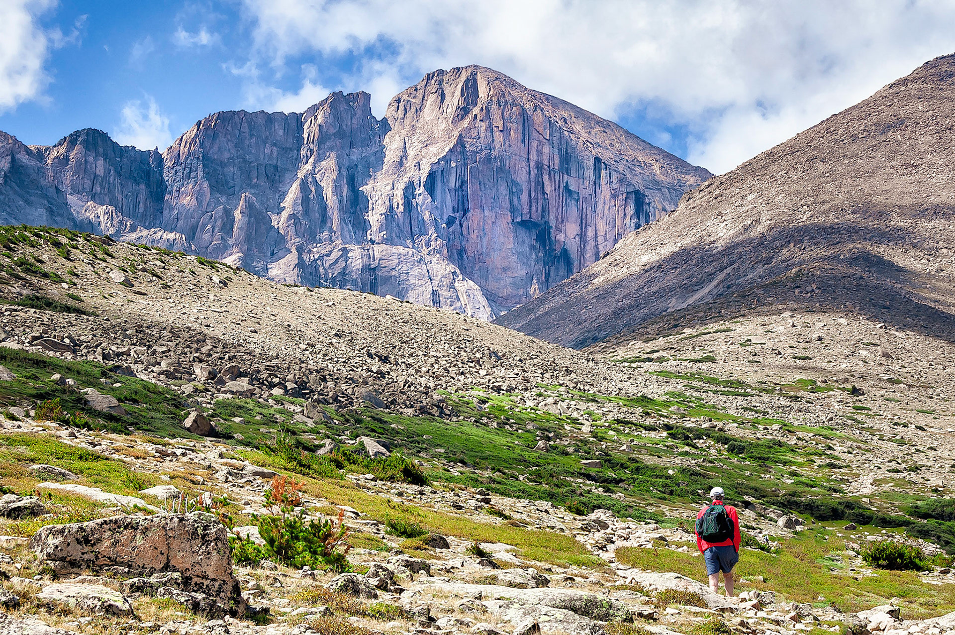
A hiker follows a rough trail up to Granite Pass in the Rocky Mountain National Park, Colorado, USA. Longs Peak, (14,259 feet=4346 m) , one of Colorodo's famed "14ers", towers above in the distance behind the scree slopes of Mount Lady Washington, (13,281feet=4,048m).
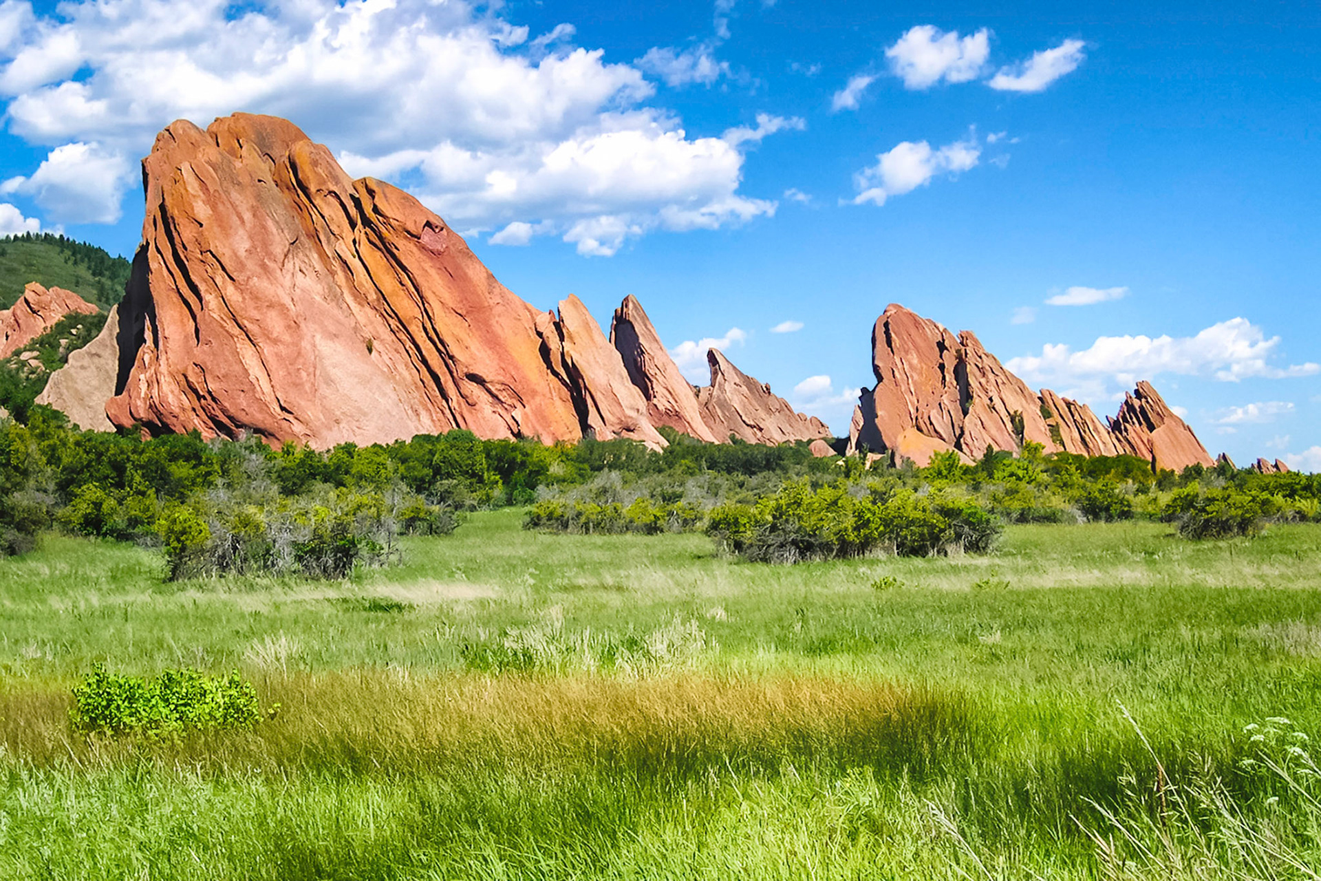
Over 300 million years old, these tilted and eroded sandstone strata are known as "Flat Irons" of Roxborough State Park. Located along the foothills of the Rocky Mountains near Denver, Colorado, USA, the region supports a varied ecosystem of Pinyion Pines, grasslands and wetlands.
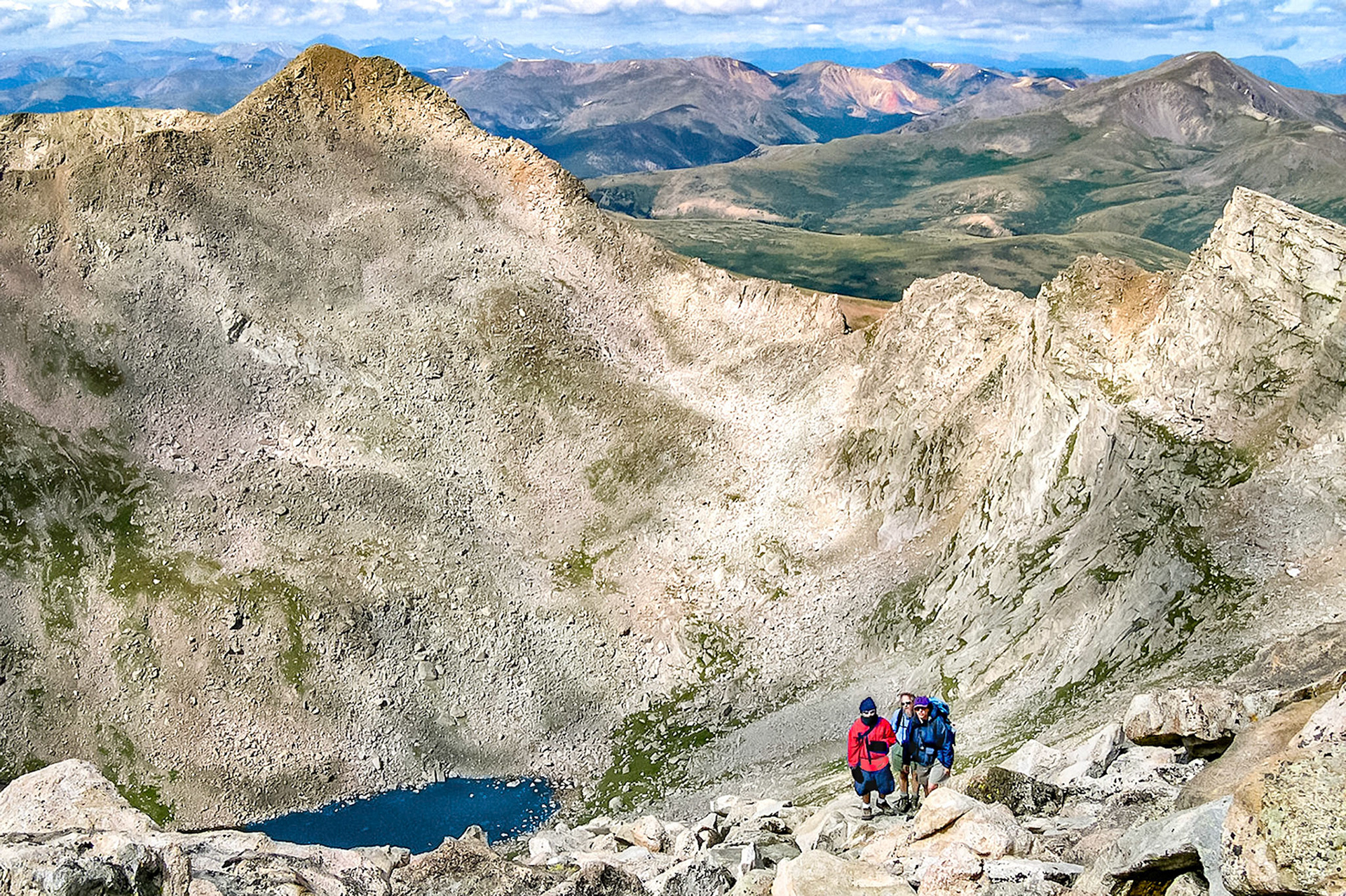
A group of hikers work their way up Mount Evans, (14,265 feet = 4,348m), as they enjoy splendid views of Abyss Lake, (12,650 feet = 3,856 meters), Mount Bierstadt, (14,060 feet = 4,285m), and The Sawtooth skyline. Beyond lies Guanella Pass and mountains of the USA Continental Divide.